Area Overview for LS17 5XE
Photos of LS17 5XE

Area Information
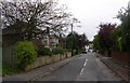
LS17 5XE is a compact residential postcode in England, home to 1,778 residents. This small cluster of homes is characterised by a mature demographic, with a median age of 47 and a majority of residents aged 30–64. The area’s proximity to key amenities, including schools, rail links, and retail hubs, makes it appealing for families and commuters. Daily life here is shaped by a balance of local convenience and broader connectivity. Residents benefit from excellent broadband, rated at 100 out of 100, ensuring seamless digital access for work or leisure. While the area lacks natural constraints like protected woodlands or wetlands, it is not without challenges. Crime rates are above average, with a safety score of 33, necessitating caution and security measures. Nonetheless, LS17 5XE offers a quiet, residential environment with practical access to nearby cities and transport networks, making it a viable option for those prioritising stability and infrastructure.
- Area Type
- Postcode
- Area Size
- Not available
- Population
- 1778
- Population Density
- 4254 people/km²
The property market in LS17 5XE is dominated by owner-occupied homes, though the 41% home ownership rate suggests a significant portion of the housing stock is rented. The area’s primary accommodation type is houses, which is typical of a suburban setting with larger properties. This mix of ownership and rental availability may appeal to buyers seeking a balance between stability and flexibility. Given the small size of the postcode, the immediate surroundings likely offer similar housing options, though the limited data prevents a broader assessment. The broadband score of 100 and mobile coverage of 85 make this area attractive for professionals requiring reliable digital connectivity. However, the low home ownership rate may indicate a competitive rental market, which buyers should consider when evaluating long-term investment potential.
House Prices in LS17 5XE
No properties found in this postcode.
Energy Efficiency in LS17 5XE
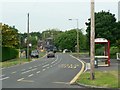
The lifestyle in LS17 5XE is shaped by its accessible amenities, including retail and transport hubs. Local shops such as Co-op Alwoodley, Spar, and Asda Alwoodley provide everyday convenience, while nearby rail stations offer seamless connections to cities like Leeds. The area’s proximity to Leeds Bradford Airport enhances travel options, making it practical for both business and leisure trips. Though the data does not specify parks or leisure facilities, the absence of planning constraints like protected woodlands suggests open spaces may be available nearby. The combination of retail outlets, transport links, and proximity to major infrastructure creates a functional environment for daily living. Residents benefit from a balance of local services and broader connectivity, supporting both independent living and integration with larger urban networks.
Amenities
Schools
Residents of LS17 5XE have access to three primary schools within practical reach. Fir Tree Primary School and Fir Tree Middle School cater to younger children, though the latter’s designation as a primary school may suggest a local focus rather than a secondary education option. Primley Wood Primary School holds an Ofsted rating of ‘good’, offering a benchmark of quality for families seeking reliable education. The availability of multiple primary schools ensures proximity to schooling, though the absence of secondary schools in the data means parents may need to consider nearby areas for older children. This mix of schools supports families with young children but highlights the need for additional research into secondary education options beyond LS17 5XE.
| Rank | School | Type | Entry gender | Ages |
|---|
Explore more schools in this area
Go to Schools tabDemographics
The population of LS17 5XE skews towards adults aged 30–64, reflecting a community of established residents rather than a transient demographic. With a median age of 47, the area lacks a significant younger or elderly population. Home ownership is relatively low, at 41%, suggesting a higher proportion of rental properties. The predominant accommodation type is houses, indicating a low-density, suburban character. The majority of residents identify as White, with no specific data on other ethnic groups provided. This demographic profile aligns with a stable, middle-aged community focused on long-term residency. The absence of detailed deprivation data means quality of life factors like access to services or employment opportunities are not quantified here, though the presence of schools and transport links implies reasonable infrastructure.
Household Size
Accommodation Type
Tenure
Ethnic Group
Religion
Household Composition
Age
Household Deprivation
NS-SEC
Explore more demographic insights in this area
Go to Demographics tabPlanning
Planning Constraints
- Flood RiskPremium
- Ramsar Wetland SitesPremium
- Area of Outstanding Natural BeautyPremium
- Protected Nature ReservePremium
- Protected WoodlandPremium