Area Overview for LS16 9JF
Photos of LS16 9JF
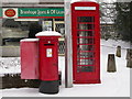
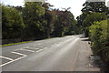
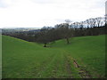
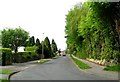
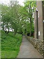
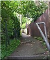
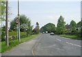
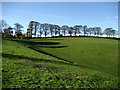
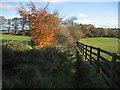
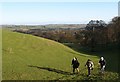
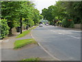
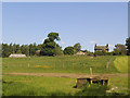
70 photos from this area
Area Information
Key information about the LS16 9JF including its size, population, and administrative classification.
- Area Type
- Postcode
- Area Size
- 27.1 hectares
- Population
- 1463
- Population Density
- 161 people/km²
House Prices in LS16 9JF
22
Properties
£885,727
Average Sold Price
£280,000
Lowest Price
£1,629,901
Highest Price
Showing 22 properties
| Address | Type | Beds | Baths | Last Sale Price | Last Sale Date | |
|---|---|---|---|---|---|---|
| The Spinney, 47 Hall Drive, Bramhope, Leeds, LS16 9JF | Detached | 2 | 4 | £925,000 | Dec 2023 | |
| Dale Cottage, Hall Drive, Bramhope, Leeds, LS16 9JF | Cottage | 3 | 2 | £775,000 | Jul 2023 | |
| Beechcroft, 17 Hall Drive, Bramhope, Leeds, LS16 9JF | Retail | 4 | 2 | £950,000 | Aug 2022 | |
| Stonehill Gables, 25 Hall Drive, Bramhope, Leeds, LS16 9JF | house | 4 | - | £1,000,000 | Mar 2022 | |
| Red Kite Hall, 7 Hall Drive, Bramhope, Leeds, LS16 9JF | Detached | 5 | 3 | £1,629,901 | Sep 2021 | |
| 5 Hall Drive, Bramhope, Leeds, LS16 9JF | Detached | 4 | - | £925,000 | Jan 2016 | |
| 41 Hall Drive, Bramhope, Leeds, LS16 9JF | Detached | 5 | - | £951,500 | Oct 2015 | |
| 45 Hall Drive, Bramhope, Leeds, LS16 9JF | Detached | 6 | - | £1,000,000 | Oct 2013 | |
| Springbank, 11 Hall Drive, Bramhope, Leeds, LS16 9JF | Detached | 4 | - | £810,000 | Aug 2013 | |
| 45A Hall Drive, Bramhope, Leeds, LS16 9JF | house | - | - | £925,000 | Oct 2010 |
Page 1 of 3
Energy Efficiency in LS16 9JF
Amenities
Schools
| Rank | School | Type | Entry gender | Ages |
|---|
Explore more schools in this area
Go to Schools tabDemographics
Household Size
Two person
most common
Accommodation Type
Houses
most common
Tenure
89
majority
Ethnic Group
White
most common
Religion
N/A
most common
Household Composition
N/A
most common
Age
47
median
Adults (30-64 years)
most common
Household Deprivation
N/A
with no deprivation
NS-SEC
57
in Lower managerial occupations
Explore more demographic insights in this area
Go to Demographics tabPlanning
Planning Constraints
- Flood RiskPremium
- Ramsar Wetland SitesPremium
- Area of Outstanding Natural BeautyPremium
- Protected Nature ReservePremium
- Protected WoodlandPremium