Area Overview for LS16 8DE
Photos of LS16 8DE
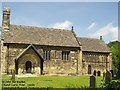
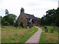
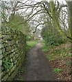
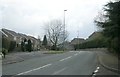


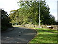
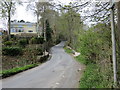
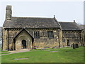
100 photos from this area
Area Information
Key information about the LS16 8DE including its size, population, and administrative classification.
- Area Type
- Postcode
- Area Size
- 11.4 hectares
- Population
- 1550
- Population Density
- 1917 people/km²
House Prices in LS16 8DE
20
Properties
£529,308
Average Sold Price
£136,000
Lowest Price
£980,000
Highest Price
Showing 20 properties
| Address | Type | Beds | Baths | Last Sale Price | Last Sale Date | |
|---|---|---|---|---|---|---|
| Smithy Cottage, Church Lane, Adel, Leeds, LS16 8DE | Detached | 2 | 1 | £530,000 | Jul 2025 | |
| Cedar House, Church Lane, Adel, Leeds, LS16 8DE | Detached | 3 | 1 | £615,000 | Aug 2023 | |
| Holly House, Church Lane, Adel, Leeds, LS16 8DE | Semi-detached | 3 | 1 | £570,000 | Feb 2023 | |
| Glebe House, Church Lane, Adel, Leeds, LS16 8DE | house | 3 | - | £980,000 | Jun 2021 | |
| Highfields, Church Lane, Adel, Leeds, LS16 8DE | Bungalow | 3 | 2 | £415,000 | Dec 2020 | |
| The School House, 32 Church Lane, Adel, Leeds, LS16 8DE | Semi-detached | 2 | 1 | £325,000 | Apr 2020 | |
| 30 Church Lane, Adel, Leeds, LS16 8DE | Detached | 6 | 1 | £590,000 | May 2019 | |
| 36 Church Lane, Adel, Leeds, LS16 8DE | Detached | 5 | 2 | £675,000 | Jun 2018 | |
| Cricketers Cottage, Church Lane, Adel, Leeds, LS16 8DE | house | - | - | £425,000 | Aug 2014 | |
| Glebe End, Church Lane, Adel, Leeds, LS16 8DE | house | - | - | £535,000 | Nov 2006 |
Page 1 of 2
Energy Efficiency in LS16 8DE
Amenities
Schools
| Rank | School | Type | Entry gender | Ages |
|---|
Explore more schools in this area
Go to Schools tabDemographics
Household Size
Two person
most common
Accommodation Type
Houses
most common
Tenure
83
majority
Ethnic Group
White
most common
Religion
N/A
most common
Household Composition
N/A
most common
Age
47
median
Adults (30-64 years)
most common
Household Deprivation
N/A
with no deprivation
NS-SEC
54
in Lower managerial occupations
Explore more demographic insights in this area
Go to Demographics tabPlanning
Planning Constraints
- Flood RiskPremium
- Ramsar Wetland SitesPremium
- Area of Outstanding Natural BeautyPremium
- Protected Nature ReservePremium
- Protected WoodlandPremium