Area Overview for LS16 7RZ
Photos of LS16 7RZ
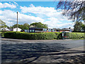
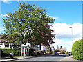
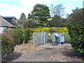
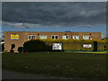
100 photos from this area
Area Information
Key information about the LS16 7RZ including its size, population, and administrative classification.
- Area Type
- Postcode
- Area Size
- 2.0 hectares
- Population
- 1418
- Population Density
- 3423 people/km²
House Prices in LS16 7RZ
56
Properties
£120,423
Average Sold Price
£19,600
Lowest Price
£200,000
Highest Price
Showing 56 properties
| Address | Type | Beds | Baths | Last Sale Price | Last Sale Date | |
|---|---|---|---|---|---|---|
| 20 Holtdale Grove, Adel, Leeds, LS16 7RZ | Terraced | 3 | 2 | £155,000 | Aug 2025 | |
| 38 Holtdale Grove, Adel, Leeds, LS16 7RZ | Terraced | 4 | 1 | £200,000 | Jun 2025 | |
| 40 Holtdale Grove, Adel, Leeds, LS16 7RZ | Terraced | 2 | 2 | £155,000 | Nov 2024 | |
| 46 Holtdale Grove, Adel, Leeds, LS16 7RZ | house | - | - | £195,000 | Oct 2021 | |
| 34 Holtdale Grove, Adel, Leeds, LS16 7RZ | Terraced | 4 | - | £172,500 | Aug 2021 | |
| 19 Holtdale Grove, Adel, Leeds, LS16 7RZ | Terraced | 4 | - | £160,000 | Oct 2020 | |
| 48 Holtdale Grove, Adel, Leeds, LS16 7RZ | Flat | 1 | 1 | £69,000 | Dec 2018 | |
| 32 Holtdale Grove, Adel, Leeds, LS16 7RZ | house | - | - | £120,000 | Aug 2017 | |
| 33 Holtdale Grove, Adel, Leeds, LS16 7RZ | house | - | - | £120,500 | Oct 2006 | |
| 7 Holtdale Grove, Adel, Leeds, LS16 7RZ | house | 3 | - | £79,950 | Apr 2003 |
Page 1 of 6
Energy Efficiency in LS16 7RZ
Amenities
Schools
| Rank | School | Type | Entry gender | Ages |
|---|
Explore more schools in this area
Go to Schools tabDemographics
Household Size
One person
most common
Accommodation Type
Houses
most common
Tenure
35
majority
Ethnic Group
White
most common
Religion
N/A
most common
Household Composition
N/A
most common
Age
47
median
Adults (30-64 years)
most common
Household Deprivation
N/A
with no deprivation
NS-SEC
24
in Lower managerial occupations
Explore more demographic insights in this area
Go to Demographics tabPlanning
Planning Constraints
- Flood RiskPremium
- Ramsar Wetland SitesPremium
- Area of Outstanding Natural BeautyPremium
- Protected Nature ReservePremium
- Protected WoodlandPremium