Area Overview for LS16 6BN
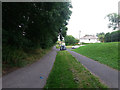
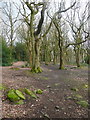
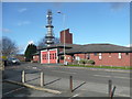
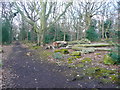
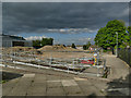
Photos of LS16 6BN

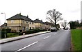
![Suburban oasis [1] in LS16 6BN](https://images.propbar.co.uk/images/geograph/18/92/1892438_120.jpg)
![Suburban oasis [2] in LS16 6BN](https://images.propbar.co.uk/images/geograph/18/92/1892439_120.jpg)

100 photos from this area
Area Information
Key information about the LS16 6BN including its size, population, and administrative classification.
- Area Type
- Postcode
- Area Size
- 2.9 hectares
- Population
- 1611
- Population Density
- 3573 people/km²
House Prices in LS16 6BN
19
Properties
£141,970
Average Sold Price
£58,500
Lowest Price
£230,000
Highest Price
Showing 19 properties
| Address | Type | Beds | Baths | Last Sale Price | Last Sale Date | |
|---|---|---|---|---|---|---|
| 79 Farrar Lane, Adel, Leeds, LS16 6BN | Semi-detached | 3 | 1 | £170,100 | Feb 2024 | |
| 77 Farrar Lane, Adel, Leeds, LS16 6BN | Semi-detached | 3 | 1 | £230,000 | Sep 2021 | |
| 83 Farrar Lane, Adel, Leeds, LS16 6BN | Detached | 3 | 1 | £192,000 | Oct 2018 | |
| 81 Farrar Lane, Adel, Leeds, LS16 6BN | house | - | - | £170,000 | Jan 2017 | |
| 75 Farrar Lane, Adel, Leeds, LS16 6BN | house | - | - | £187,000 | Dec 2016 | |
| 69 Farrar Lane, Adel, Leeds, LS16 6BN | Semi-detached | 3 | 1 | £175,000 | Jan 2016 | |
| 89 Farrar Lane, Adel, Leeds, LS16 6BN | house | 2 | - | £102,000 | Sep 2010 | |
| 65 Farrar Lane, Adel, Leeds, LS16 6BN | house | - | - | £125,000 | Jan 2010 | |
| 57 Farrar Lane, Adel, Leeds, LS16 6BN | house | - | - | £122,000 | Jun 2007 | |
| 71 Farrar Lane, Adel, Leeds, LS16 6BN | Semi-detached | - | - | £135,000 | May 2006 |
Page 1 of 2
Energy Efficiency in LS16 6BN
Amenities
Schools
| Rank | School | Type | Entry gender | Ages |
|---|
Explore more schools in this area
Go to Schools tabDemographics
Household Size
One person
most common
Accommodation Type
Houses
most common
Tenure
48
majority
Ethnic Group
White
most common
Religion
N/A
most common
Household Composition
N/A
most common
Age
47
median
Adults (30-64 years)
most common
Household Deprivation
N/A
with no deprivation
NS-SEC
27
in Lower managerial occupations
Explore more demographic insights in this area
Go to Demographics tabPlanning
Planning Constraints
- Flood RiskPremium
- Ramsar Wetland SitesPremium
- Area of Outstanding Natural BeautyPremium
- Protected Nature ReservePremium
- Protected WoodlandPremium