Area Overview for LS16 5PR
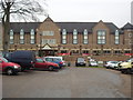
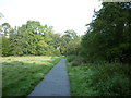
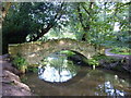
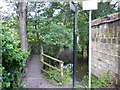
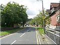
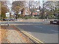
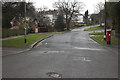
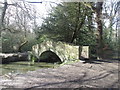
Photos of LS16 5PR


Area Information
LS16 5PR is a compact residential cluster in England, spanning just 2.4 hectares and home to 2,215 residents. Its high population density of 1,872 people per square kilometre reflects a tightly knit community, ideal for those seeking proximity to amenities without sacrificing space. The area’s character is defined by its youthful demographic, with a median age of 22 and the majority of residents aged 15–29. This suggests a dynamic, student-friendly environment, likely influenced by nearby educational institutions. Daily life here balances urban convenience with residential tranquillity, supported by nearby schools, rail links, and retail hubs. The postcode’s small size means residents are within easy reach of key services, though the area’s limited footprint may appeal to those prioritising accessibility over expansive living spaces. With no major environmental constraints or flood risks, LS16 5PR offers a practical base for young professionals, students, or families seeking a manageable, connected lifestyle.
- Area Type
- Postcode
- Area Size
- 2.4 hectares
- Population
- 2215
- Population Density
- 1872 people/km²
LS16 5PR is primarily an owner-occupied area, with 63% of properties held by residents rather than landlords. The accommodation type is predominantly houses, which, given the area’s small size, suggests a focus on single-family homes and smaller residential units. This contrasts with areas dominated by flats or rental properties, indicating a market skewed towards long-term residents rather than transient tenants. The limited land area means the housing stock is constrained, potentially driving competition among buyers. For those seeking a home here, the proximity to schools, rail links, and retail amenities may outweigh the area’s compact footprint. However, buyers should consider the lack of large-scale development opportunities, as the postcode’s size restricts expansion. The predominance of houses may appeal to families or individuals prioritising private space over shared living arrangements.
House Prices in LS16 5PR
No properties found in this postcode.
Energy Efficiency in LS16 5PR
Daily life in LS16 5PR is shaped by its proximity to retail, transport, and leisure facilities. The area’s shops include Spar, Co-op Butcher, and Co-op Spen, offering essential groceries and services within walking distance. Rail stations like Headingley and Kirkstall Forge provide easy access to Leeds city centre, while nearby airports cater to travel needs. Though the postcode’s small size limits expansive parks or recreational spaces, the surrounding area likely offers green belts or public parks for leisure. The compact nature of LS16 5PR means residents can access amenities without long commutes, fostering a convenient, community-focused lifestyle. The mix of retail and transport options supports both everyday needs and broader mobility, making it practical for young professionals, students, and families.
Amenities
Schools
Residents of LS16 5PR have access to a range of educational institutions, from primary schools to higher education. St Chad’s Church of England Primary School and Lawnswood School provide primary education, with the latter rated ‘good’ by Ofsted. The presence of two primary schools suggests a focus on early education, though the duplication of Lawnswood School’s entry may indicate a need for clarity. For alternative needs, West Park Central Pupil Referral Unit caters to students with specific requirements, while Leeds Beckett University offers higher education options. This mix of school types ensures families can find appropriate provisions, whether for mainstream education or specialised support. The proximity of these institutions to residential areas reinforces LS16 5PR’s appeal to families and students, though the absence of secondary schools nearby may require commuting for older children.
| Rank | School | Type | Entry gender | Ages |
|---|
Explore more schools in this area
Go to Schools tabDemographics
The population of LS16 5PR is overwhelmingly young, with a median age of 22 and 63% of residents aged 15–29. This age group dominates, shaping a community centred on education and early career development. Home ownership is strong, with 63% of properties owner-occupied, suggesting stability and long-term investment in the area. The accommodation type is predominantly houses, which, combined with the high population density, indicates a mix of family homes and smaller dwellings. The predominant ethnic group is White, reflecting a homogenous demographic profile. While no specific deprivation data is provided, the high home ownership rate and proximity to educational institutions suggest a community with moderate economic resources. The age profile implies a demand for student housing, rental properties, and family-friendly amenities, which may influence local property dynamics.
Household Size
Accommodation Type
Tenure
Ethnic Group
Religion
Household Composition
Age
Household Deprivation
NS-SEC
Explore more demographic insights in this area
Go to Demographics tabPlanning
Planning Constraints
- Flood RiskPremium
- Ramsar Wetland SitesPremium
- Area of Outstanding Natural BeautyPremium
- Protected Nature ReservePremium
- Protected WoodlandPremium