Area Overview for LS15 8XE
Photos of LS15 8XE
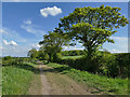
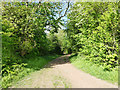
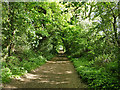
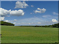
48 photos from this area
Area Information
Key information about the LS15 8XE including its size, population, and administrative classification.
- Area Type
- Postcode
- Area Size
- 69.1 hectares
- Population
- 1658
- Population Density
- 342 people/km²
House Prices in LS15 8XE
56
Properties
£150,510
Average Sold Price
£53,500
Lowest Price
£275,000
Highest Price
Showing 56 properties
| Address | Type | Beds | Baths | Last Sale Price | Last Sale Date | |
|---|---|---|---|---|---|---|
| 24 Chelsfield Way, Manston, Leeds, LS15 8XE | Bungalow | 2 | 1 | £220,000 | Aug 2025 | |
| 32 Chelsfield Way, Manston, Leeds, LS15 8XE | Semi-detached | 3 | 1 | £240,000 | Jul 2025 | |
| 37 Chelsfield Way, Manston, Leeds, LS15 8XE | Semi-detached | 2 | 1 | £200,000 | Aug 2024 | |
| 6 Chelsfield Way, Manston, Leeds, LS15 8XE | Semi-detached | 2 | 1 | £255,000 | May 2024 | |
| 58 Chelsfield Way, Manston, Leeds, LS15 8XE | Semi-detached | 3 | 1 | £235,000 | Nov 2022 | |
| 42 Chelsfield Way, Manston, Leeds, LS15 8XE | house | 1 | - | £128,000 | Jun 2022 | |
| 35 Chelsfield Way, Manston, Leeds, LS15 8XE | Semi-detached | 2 | - | £185,000 | Oct 2021 | |
| 20 Chelsfield Way, Manston, Leeds, LS15 8XE | Bungalow | 2 | - | £195,000 | Jun 2021 | |
| 11 Chelsfield Way, Manston, Leeds, LS15 8XE | Detached | 4 | 2 | £275,000 | Mar 2021 | |
| 23 Chelsfield Way, Manston, Leeds, LS15 8XE | Bungalow | 2 | 1 | £160,000 | Jan 2021 |
Page 1 of 6
Energy Efficiency in LS15 8XE
Amenities
Schools
| Rank | School | Type | Entry gender | Ages |
|---|
Explore more schools in this area
Go to Schools tabDemographics
Household Size
Two person
most common
Accommodation Type
Houses
most common
Tenure
87
majority
Ethnic Group
White
most common
Religion
N/A
most common
Household Composition
N/A
most common
Age
47
median
Adults (30-64 years)
most common
Household Deprivation
N/A
with no deprivation
NS-SEC
39
in Lower managerial occupations
Explore more demographic insights in this area
Go to Demographics tabPlanning
Planning Constraints
- Flood RiskPremium
- Ramsar Wetland SitesPremium
- Area of Outstanding Natural BeautyPremium
- Protected Nature ReservePremium
- Protected WoodlandPremium