Area Overview for LS15 8RY
Photos of LS15 8RY
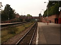
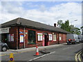
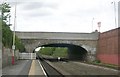
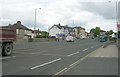
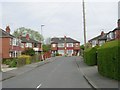
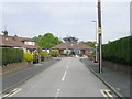
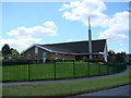
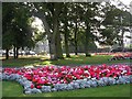

100 photos from this area
Area Information
Key information about the LS15 8RY including its size, population, and administrative classification.
- Area Type
- Postcode
- Area Size
- 1.5 hectares
- Population
- 1493
- Population Density
- 4135 people/km²
House Prices in LS15 8RY
28
Properties
£139,488
Average Sold Price
£49,000
Lowest Price
£215,000
Highest Price
Showing 28 properties
| Address | Type | Beds | Baths | Last Sale Price | Last Sale Date | |
|---|---|---|---|---|---|---|
| 110 Kennerleigh Avenue, Austhorpe, Leeds, LS15 8RY | Semi-detached | 3 | 1 | £215,000 | Jul 2025 | |
| 76 Kennerleigh Avenue, Austhorpe, Leeds, LS15 8RY | house | - | - | £206,000 | Nov 2022 | |
| 106 Kennerleigh Avenue, Austhorpe, Leeds, LS15 8RY | Semi-detached | 2 | 1 | £204,000 | Jan 2022 | |
| 82 Kennerleigh Avenue, Austhorpe, Leeds, LS15 8RY | Bungalow | 2 | 1 | £189,950 | Aug 2019 | |
| 78 Kennerleigh Avenue, Austhorpe, Leeds, LS15 8RY | Semi-detached | 2 | - | £175,000 | Feb 2019 | |
| 60 Kennerleigh Avenue, Austhorpe, Leeds, LS15 8RY | Semi-detached | 2 | 1 | £160,000 | Jan 2019 | |
| 80 Kennerleigh Avenue, Austhorpe, Leeds, LS15 8RY | Bungalow | - | - | £170,000 | Jan 2017 | |
| 86 Kennerleigh Avenue, Austhorpe, Leeds, LS15 8RY | Bungalow | 2 | 1 | £142,000 | Oct 2015 | |
| 96 Kennerleigh Avenue, Austhorpe, Leeds, LS15 8RY | Semi-detached | 2 | 1 | £153,000 | Jul 2014 | |
| 90 Kennerleigh Avenue, Austhorpe, Leeds, LS15 8RY | Bungalow | - | - | £167,000 | Mar 2014 |
Page 1 of 3
Energy Efficiency in LS15 8RY
Amenities
Schools
| Rank | School | Type | Entry gender | Ages |
|---|
Explore more schools in this area
Go to Schools tabDemographics
Household Size
Two person
most common
Accommodation Type
Houses
most common
Tenure
80
majority
Ethnic Group
White
most common
Religion
N/A
most common
Household Composition
N/A
most common
Age
47
median
Adults (30-64 years)
most common
Household Deprivation
N/A
with no deprivation
NS-SEC
31
in Lower managerial occupations
Explore more demographic insights in this area
Go to Demographics tabPlanning
Planning Constraints
- Flood RiskPremium
- Ramsar Wetland SitesPremium
- Area of Outstanding Natural BeautyPremium
- Protected Nature ReservePremium
- Protected WoodlandPremium