Area Overview for LS15 4EG
Photos of LS15 4EG
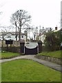
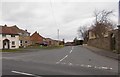
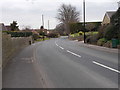
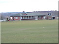
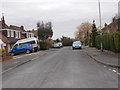
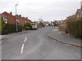
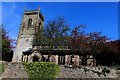
45 photos from this area
Area Information
Key information about the LS15 4EG including its size, population, and administrative classification.
- Area Type
- Postcode
- Area Size
- 4128 m²
- Population
- 1625
- Population Density
- 422 people/km²
House Prices in LS15 4EG
17
Properties
£135,031
Average Sold Price
£39,950
Lowest Price
£335,000
Highest Price
Showing 17 properties
| Address | Type | Beds | Baths | Last Sale Price | Last Sale Date | |
|---|---|---|---|---|---|---|
| 22 Chapel Lane, Barwick In Elmet, Leeds, LS15 4EG | Terraced | 2 | 1 | £210,000 | Dec 2023 | |
| 5 Chapel Lane, Barwick In Elmet, Leeds, LS15 4EG | Terraced | 2 | 1 | £215,000 | Jul 2023 | |
| 2-4 Chapel Lane, Barwick In Elmet, Leeds, LS15 4EG | house | - | - | £335,000 | Aug 2020 | |
| 9 Chapel Lane, Barwick In Elmet, Leeds, LS15 4EG | Terraced | 2 | 1 | £180,000 | Jul 2020 | |
| 1 Chapel Lane, Barwick In Elmet, Leeds, LS15 4EG | Terraced | 3 | - | £55,000 | Dec 2012 | |
| 10 Chapel Lane, Barwick In Elmet, Leeds, LS15 4EG | house | - | - | £133,000 | Jul 2009 | |
| 8 Chapel Lane, Barwick In Elmet, Leeds, LS15 4EG | house | - | - | £119,000 | Aug 2006 | |
| 15 Chapel Lane, Barwick In Elmet, Leeds, LS15 4EG | Terraced | 3 | 2 | £168,500 | May 2006 | |
| 13 Chapel Lane, Barwick In Elmet, Leeds, LS15 4EG | Terraced | 2 | - | £99,950 | Nov 2002 | |
| 18 Chapel Lane, Barwick In Elmet, Leeds, LS15 4EG | Terraced | - | - | £93,000 | Jul 2001 |
Page 1 of 2
Energy Efficiency in LS15 4EG
Amenities
Schools
| Rank | School | Type | Entry gender | Ages |
|---|
Explore more schools in this area
Go to Schools tabDemographics
Household Size
Two person
most common
Accommodation Type
Houses
most common
Tenure
86
majority
Ethnic Group
White
most common
Religion
N/A
most common
Household Composition
N/A
most common
Age
47
median
Adults (30-64 years)
most common
Household Deprivation
N/A
with no deprivation
NS-SEC
44
in Lower managerial occupations
Explore more demographic insights in this area
Go to Demographics tabPlanning
Planning Constraints
- Flood RiskPremium
- Ramsar Wetland SitesPremium
- Area of Outstanding Natural BeautyPremium
- Protected Nature ReservePremium
- Protected WoodlandPremium