Area Overview for LS14 2EG
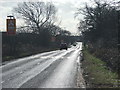
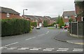
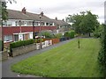
Photos of LS14 2EG

Area Information
LS14 2EG is a compact residential postcode area in England, covering just 3.1 hectares and home to 1,621 residents. Its high population density of 52,445 people per square kilometre reflects a tightly knit community, where daily life is shaped by proximity to local amenities and transport links. The area is characterised by its focus on family-oriented living, with a median age of 47 and a majority of residents aged between 30 and 64. This suggests a mature, stable population, many of whom are likely to be long-term residents. The small size of the area means that residents can access nearby services and schools without long commutes, though the limited space also means the housing stock is finite. Living here involves navigating a balance between the convenience of proximity and the constraints of a small, densely populated environment. The area’s appeal lies in its practicality, with essential services within reach and a straightforward layout that suits those prioritising accessibility over expansive space.
- Area Type
- Postcode
- Area Size
- 3.1 hectares
- Population
- 1621
- Population Density
- 3338 people/km²
The property market in LS14 2EG is dominated by owner-occupied homes, with 63% of residents owning their properties. This suggests a stable market with limited turnover, as the area is not primarily a rental hub. The accommodation type is predominantly houses, which is unusual for a small postcode area but may indicate a mix of older, larger properties or detached homes. Given the area’s size and population density, the housing stock is likely to be constrained, with limited scope for new developments. Buyers should consider that the market may be competitive, particularly for properties that meet the needs of the area’s mature demographic. The focus on houses rather than flats or apartments means that buyers seeking larger homes may find more options here than in denser urban areas. However, the small footprint of LS14 2EG means that properties are likely to be in close proximity to each other, with little room for expansion.
House Prices in LS14 2EG
No properties found in this postcode.
Energy Efficiency in LS14 2EG
Residents of LS14 2EG benefit from nearby retail options, including Asda Wetherby, M&S Red Hall BP, and Tesco Leeds, which provide essential shopping and dining facilities. These stores cater to daily needs, from groceries to clothing, reducing the necessity for long trips to larger centres. The area’s rail connections, with stations at Cross Gates, Garforth, and Leeds, offer easy access to broader regional amenities, including cultural hubs, entertainment venues, and additional retail districts. While the data does not mention parks or leisure facilities, the proximity to rail links suggests that residents can quickly reach green spaces or recreational areas in nearby towns. The compact nature of the area means that daily life revolves around these immediate amenities, creating a self-contained environment where convenience is prioritised over extensive local offerings. The blend of retail and transport access supports a practical lifestyle, though those seeking more diverse leisure options may need to venture beyond the immediate postcode.
Amenities
Schools
Residents of LS14 2EG have access to two primary schools: Fieldhead Carr Primary School, which holds an Ofsted rating of ‘good’, and Whinmoor Middle School. Both institutions serve the local community, though the latter’s rating is not specified in the data. The presence of two primary schools indicates that families with young children have nearby options, though the absence of secondary schools within the area may require commuting to larger towns or cities. Fieldhead Carr’s ‘good’ rating suggests a school that meets standard educational benchmarks, offering a reliable foundation for early education. However, the lack of detailed performance metrics for Whinmoor Middle School means potential homebuyers should investigate further to understand its quality. The concentration of primary schools supports a family-friendly environment, but the absence of higher-tier educational facilities may be a consideration for those prioritising a comprehensive local school system.
| Rank | School | Type | Entry gender | Ages |
|---|
Explore more schools in this area
Go to Schools tabDemographics
The community in LS14 2EG is predominantly composed of adults aged 30 to 64, with a median age of 47. This age range indicates a population that is largely in or nearing their prime working years, suggesting a stable economic base. Home ownership is high, with 63% of residents owning their homes, a figure that points to a community of established households rather than a transient rental market. The accommodation type is primarily houses, which aligns with the higher proportion of owner-occupied properties. The predominant ethnic group is White, though no specific data on diversity or deprivation is provided. The high population density of 52,445 people per square kilometre implies a compact, possibly urbanised setting, where shared resources and services are central to daily life. This density may influence the character of the area, fostering a sense of community while also necessitating efficient use of space.
Household Size
Accommodation Type
Tenure
Ethnic Group
Religion
Household Composition
Age
Household Deprivation
NS-SEC
Explore more demographic insights in this area
Go to Demographics tabPlanning
Planning Constraints
- Flood RiskPremium
- Ramsar Wetland SitesPremium
- Area of Outstanding Natural BeautyPremium
- Protected Nature ReservePremium
- Protected WoodlandPremium