Area Overview for LS14 2DJ
Photos of LS14 2DJ
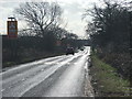
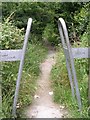

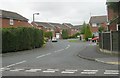
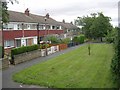

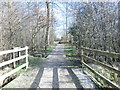
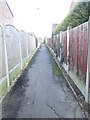
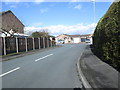
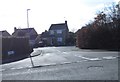
67 photos from this area
Area Information
Key information about the LS14 2DJ including its size, population, and administrative classification.
- Area Type
- Postcode
- Area Size
- 2.1 hectares
- Population
- 1621
- Population Density
- 3338 people/km²
House Prices in LS14 2DJ
56
Properties
£157,667
Average Sold Price
£58,500
Lowest Price
£250,000
Highest Price
Showing 56 properties
| Address | Type | Beds | Baths | Last Sale Price | Last Sale Date | |
|---|---|---|---|---|---|---|
| 54 Hathaway Drive, Whinmoor, Leeds, LS14 2DJ | Semi-detached | 3 | 1 | £240,000 | Jul 2025 | |
| 16 Hathaway Drive, Whinmoor, Leeds, LS14 2DJ | house | - | - | £237,000 | Mar 2025 | |
| 17 Hathaway Drive, Whinmoor, Leeds, LS14 2DJ | Semi-detached | 3 | 1 | £240,000 | Jan 2025 | |
| 41 Hathaway Drive, Whinmoor, Leeds, LS14 2DJ | house | - | - | £140,000 | Feb 2024 | |
| 7 Hathaway Drive, Whinmoor, Leeds, LS14 2DJ | Detached | 3 | 1 | £248,000 | Jan 2023 | |
| 29 Hathaway Drive, Whinmoor, Leeds, LS14 2DJ | Retail | 3 | - | £250,000 | May 2022 | |
| 37 Hathaway Drive, Whinmoor, Leeds, LS14 2DJ | house | - | - | £175,000 | Nov 2020 | |
| 5 Hathaway Drive, Whinmoor, Leeds, LS14 2DJ | Detached | 3 | 1 | £210,000 | Nov 2020 | |
| 18 Hathaway Drive, Whinmoor, Leeds, LS14 2DJ | Semi-detached | 3 | 1 | £185,000 | Oct 2019 | |
| 15 Hathaway Drive, Whinmoor, Leeds, LS14 2DJ | Semi-detached | 3 | 1 | £180,000 | Aug 2019 |
Page 1 of 6
Energy Efficiency in LS14 2DJ
Amenities
Schools
| Rank | School | Type | Entry gender | Ages |
|---|
Explore more schools in this area
Go to Schools tabDemographics
Household Size
One person
most common
Accommodation Type
Houses
most common
Tenure
63
majority
Ethnic Group
White
most common
Religion
N/A
most common
Household Composition
N/A
most common
Age
47
median
Adults (30-64 years)
most common
Household Deprivation
N/A
with no deprivation
NS-SEC
29
in Lower managerial occupations
Explore more demographic insights in this area
Go to Demographics tabPlanning
Planning Constraints
- Flood RiskPremium
- Ramsar Wetland SitesPremium
- Area of Outstanding Natural BeautyPremium
- Protected Nature ReservePremium
- Protected WoodlandPremium