Area Overview for LS13 4EW
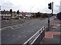
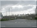
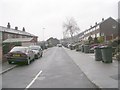
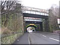
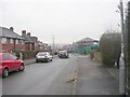
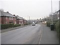
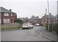
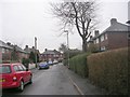
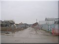
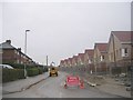
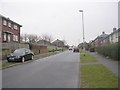
Photos of LS13 4EW

Area Information
LS13 4EW is a small, tightly knit residential cluster in the Pudsey Ward of Leeds, West Yorkshire. With a population of 1,648, it reflects the character of a traditional English suburb, where homes are predominantly owner-occupied and family-focused. The area sits within a historically significant region, once a hub for woollen manufacturing in the 18th and 19th centuries. Today, its proximity to Bramley Railway Station and nearby airports like Leeds Bradford International Airport makes it accessible for commuters and travellers. Daily life here is shaped by a mix of local shops, including Tesco Stanningley Half and Lidl Bramley, and a quiet residential rhythm. The median age of 47 suggests a mature community, with many residents in their prime working years. While the area lacks major commercial centres, its small size fosters a sense of familiarity, with landmarks like Pudsey Park and historic cricket clubs adding to its charm. For buyers, LS13 4EW offers a blend of practicality and heritage, though its modest scale means the surrounding areas are key for broader amenities.
- Area Type
- Postcode
- Area Size
- Not available
- Population
- 1648
- Population Density
- 2698 people/km²
The property market in LS13 4EW is dominated by owner-occupied homes, with 77% of properties in private hands. This suggests a stable, long-term market with limited rental activity, which can be advantageous for buyers seeking security in their investment. The predominance of houses over flats indicates a focus on family homes, likely with larger gardens and more space, catering to the area’s mature demographic. Given the small size of the postcode area, the housing stock is likely limited, meaning buyers may need to consider nearby suburbs for a broader range of options. The high home ownership rate also implies strong local ties, with fewer speculative purchases or short-term rentals. For those seeking a home in LS13 4EW, the market offers a mix of traditional properties, but buyers should be prepared to look beyond the immediate postcode for more variety.
House Prices in LS13 4EW
No properties found in this postcode.
Energy Efficiency in LS13 4EW
Life in LS13 4EW is shaped by its proximity to local amenities, including five retail outlets such as Tesco Stanningley Half, Co-op Swinnow, and Lidl Bramley, ensuring everyday shopping needs are met. The area’s railway stations, including Bramley and New Pudsey, provide easy access to public transport, while nearby airports cater to those with travel demands. Recreational opportunities are anchored by Pudsey Park, a historic green space that hosts community events and offers walking and leisure activities. The area also retains historical charm, with listed buildings and cricket clubs like Pudsey St Lawrence, founded in 1845, adding to its character. While the small postcode limits the density of amenities, the surrounding Pudsey Ward offers a broader range of services, from schools to cultural sites. This balance of convenience and heritage creates a lifestyle that feels rooted in tradition yet connected to modern needs.
Amenities
Schools
| Rank | School | Type | Entry gender | Ages |
|---|
Explore more schools in this area
Go to Schools tabDemographics
The community in LS13 4EW is predominantly composed of adults aged 30–64, with a median age of 47. This suggests a stable, middle-aged population, likely with established careers and family ties. Home ownership is high at 77%, indicating a strong preference for long-term residency over rental living. The area is characterised by houses rather than flats, reflecting a focus on family-friendly housing. The predominant ethnic group is White, though specific data on diversity or minority representation is not provided. The absence of detailed deprivation metrics means the area’s socioeconomic profile remains largely unquantified, but the high home ownership rate and mature age demographic imply a relatively secure financial environment. For residents, this translates to a community with low turnover and a shared sense of place, though the lack of younger demographics may affect local amenities and services tailored to children or students.
Household Size
Accommodation Type
Tenure
Ethnic Group
Religion
Household Composition
Age
Household Deprivation
NS-SEC
Explore more demographic insights in this area
Go to Demographics tabPlanning
Planning Constraints
- Flood RiskPremium
- Ramsar Wetland SitesPremium
- Area of Outstanding Natural BeautyPremium
- Protected Nature ReservePremium
- Protected WoodlandPremium