Area Overview for LS13 3DF
Photos of LS13 3DF
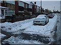
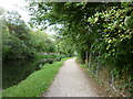
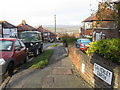
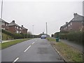
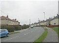
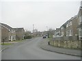
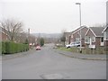
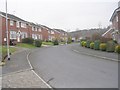
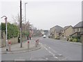
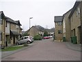
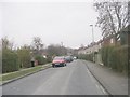
100 photos from this area
Area Information
Key information about the LS13 3DF including its size, population, and administrative classification.
- Area Type
- Postcode
- Area Size
- 1.2 hectares
- Population
- 1493
- Population Density
- 4426 people/km²
House Prices in LS13 3DF
27
Properties
£141,303
Average Sold Price
£38,000
Lowest Price
£288,500
Highest Price
Showing 27 properties
| Address | Type | Beds | Baths | Last Sale Price | Last Sale Date | |
|---|---|---|---|---|---|---|
| 398 Broad Lane, Bramley, Leeds, LS13 3DF | Semi-detached | 3 | 1 | £210,000 | Feb 2023 | |
| 394A Broad Lane, Bramley, Leeds, LS13 3DF | house | - | - | £212,000 | Nov 2021 | |
| 406 Broad Lane, Bramley, Leeds, LS13 3DF | house | - | - | £180,000 | Apr 2021 | |
| 414 Broad Lane, Bramley, Leeds, LS13 3DF | house | 3 | - | £288,500 | Jan 2021 | |
| 426 Broad Lane, Bramley, Leeds, LS13 3DF | Terraced | 2 | 1 | £161,000 | Apr 2019 | |
| 424 Broad Lane, Bramley, Leeds, LS13 3DF | house | - | - | £94,000 | Sep 2018 | |
| 392 Broad Lane, Bramley, Leeds, LS13 3DF | Terraced | 2 | 1 | £79,000 | Oct 2015 | |
| 412 Broad Lane, Bramley, Leeds, LS13 3DF | Terraced | 3 | - | £249,999 | Apr 2015 | |
| 420 Broad Lane, Bramley, Leeds, LS13 3DF | Terraced | 3 | 1 | £129,950 | Dec 2014 | |
| 404 Broad Lane, Bramley, Leeds, LS13 3DF | Semi-detached | 3 | 1 | £132,999 | Oct 2013 |
Page 1 of 3
Energy Efficiency in LS13 3DF
Amenities
Schools
| Rank | School | Type | Entry gender | Ages |
|---|
Explore more schools in this area
Go to Schools tabDemographics
Household Size
Two person
most common
Accommodation Type
Houses
most common
Tenure
80
majority
Ethnic Group
White
most common
Religion
N/A
most common
Household Composition
N/A
most common
Age
47
median
Adults (30-64 years)
most common
Household Deprivation
N/A
with no deprivation
NS-SEC
35
in Lower managerial occupations
Explore more demographic insights in this area
Go to Demographics tabPlanning
Planning Constraints
- Flood RiskPremium
- Ramsar Wetland SitesPremium
- Area of Outstanding Natural BeautyPremium
- Protected Nature ReservePremium
- Protected WoodlandPremium