Area Overview for LS13 2TA
Photos of LS13 2TA
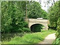
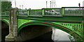
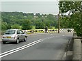
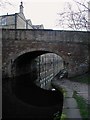
100 photos from this area
Area Information
Key information about the LS13 2TA including its size, population, and administrative classification.
- Area Type
- Postcode
- Area Size
- 9377 m²
- Population
- 1837
- Population Density
- 3103 people/km²
House Prices in LS13 2TA
32
Properties
£100,650
Average Sold Price
£32,000
Lowest Price
£166,000
Highest Price
Showing 32 properties
| Address | Type | Beds | Baths | Last Sale Price | Last Sale Date | |
|---|---|---|---|---|---|---|
| 1B Broadlea Avenue, Bramley, Leeds, LS13 2TA | Terraced | 3 | 1 | £140,000 | Jul 2024 | |
| 9 Broadlea Avenue, Bramley, Leeds, LS13 2TA | Terraced | 3 | 1 | £150,000 | May 2024 | |
| 11 Broadlea Avenue, Bramley, Leeds, LS13 2TA | Terraced | 3 | 1 | £166,000 | Jul 2022 | |
| 15 Broadlea Avenue, Bramley, Leeds, LS13 2TA | house | - | - | £118,500 | Mar 2021 | |
| 18 Broadlea Avenue, Bramley, Leeds, LS13 2TA | Detached | 2 | 1 | £83,000 | Sep 2016 | |
| 20 Broadlea Avenue, Bramley, Leeds, LS13 2TA | Semi-detached | 2 | 1 | £82,000 | Feb 2016 | |
| 29 Broadlea Avenue, Bramley, Leeds, LS13 2TA | Terraced | 3 | 1 | £67,000 | Aug 2015 | |
| 1A Broadlea Avenue, Bramley, Leeds, LS13 2TA | Semi-detached | 3 | 1 | £90,000 | Aug 2014 | |
| 3 Broadlea Avenue, Bramley, Leeds, LS13 2TA | house | - | - | £78,000 | Jan 2006 | |
| 1 Broadlea Avenue, Bramley, Leeds, LS13 2TA | Semi-detached | 3 | 1 | £32,000 | Nov 1995 |
Page 1 of 4
Energy Efficiency in LS13 2TA
Amenities
Schools
| Rank | School | Type | Entry gender | Ages |
|---|
Explore more schools in this area
Go to Schools tabDemographics
Household Size
Family (3-5 people)
most common
Accommodation Type
Houses
most common
Tenure
17
majority
Ethnic Group
White
most common
Religion
N/A
most common
Household Composition
N/A
most common
Age
22
median
Young Adults (15-29 years)
most common
Household Deprivation
N/A
with no deprivation
NS-SEC
9
in Lower managerial occupations
Explore more demographic insights in this area
Go to Demographics tabPlanning
Planning Constraints
- Flood RiskPremium
- Ramsar Wetland SitesPremium
- Area of Outstanding Natural BeautyPremium
- Protected Nature ReservePremium
- Protected WoodlandPremium