Area Overview for LS13 2LD
Photos of LS13 2LD
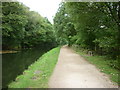
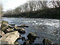
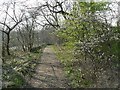
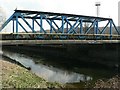
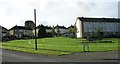
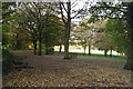
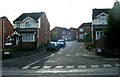
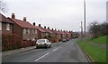
100 photos from this area
Area Information
Key information about the LS13 2LD including its size, population, and administrative classification.
- Area Type
- Postcode
- Area Size
- 5116 m²
- Population
- 1644
- Population Density
- 1192 people/km²
House Prices in LS13 2LD
19
Properties
£121,083
Average Sold Price
£52,000
Lowest Price
£198,500
Highest Price
Showing 19 properties
| Address | Type | Beds | Baths | Last Sale Price | Last Sale Date | |
|---|---|---|---|---|---|---|
| 17 St Catherines Drive, Bramley, Leeds, LS13 2LD | Semi-detached | 3 | 1 | £198,500 | Jan 2024 | |
| 31 St Catherines Drive, Bramley, Leeds, LS13 2LD | Semi-detached | 2 | - | £155,000 | Aug 2021 | |
| 11 St Catherines Drive, Bramley, Leeds, LS13 2LD | house | - | - | £131,000 | Jun 2021 | |
| 3 St Catherines Drive, Bramley, Leeds, LS13 2LD | Semi-detached | 2 | - | £125,000 | Jul 2016 | |
| 19 St Catherines Drive, Bramley, Leeds, LS13 2LD | Semi-detached | - | - | £64,995 | Mar 2003 | |
| 15 St Catherines Drive, Bramley, Leeds, LS13 2LD | Semi-detached | - | - | £52,000 | Feb 2003 | |
| 33 St Catherines Drive, Bramley, Leeds, LS13 2LD | Detached | 2 | 1 | - | - | |
| 23 St Catherines Drive, Bramley, Leeds, LS13 2LD | Semi-detached | 2 | 1 | - | - | |
| 37 St Catherines Drive, Bramley, Leeds, LS13 2LD | house | - | - | - | - | |
| 5 St Catherines Drive, Bramley, Leeds, LS13 2LD | house | - | - | - | - |
Page 1 of 2
Energy Efficiency in LS13 2LD
Amenities
Schools
| Rank | School | Type | Entry gender | Ages |
|---|
Explore more schools in this area
Go to Schools tabDemographics
Household Size
Two person
most common
Accommodation Type
Houses
most common
Tenure
65
majority
Ethnic Group
White
most common
Religion
N/A
most common
Household Composition
N/A
most common
Age
47
median
Adults (30-64 years)
most common
Household Deprivation
N/A
with no deprivation
NS-SEC
37
in Lower managerial occupations
Explore more demographic insights in this area
Go to Demographics tabPlanning
Planning Constraints
- Flood RiskPremium
- Ramsar Wetland SitesPremium
- Area of Outstanding Natural BeautyPremium
- Protected Nature ReservePremium
- Protected WoodlandPremium