Area Overview for LS13 1JT
Photos of LS13 1JT
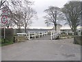
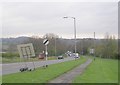
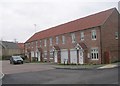
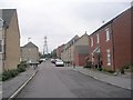
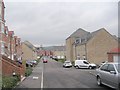
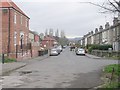
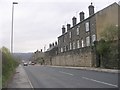
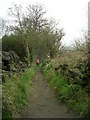
100 photos from this area
Area Information
Key information about the LS13 1JT including its size, population, and administrative classification.
- Area Type
- Postcode
- Area Size
- 3975 m²
- Population
- 1637
- Population Density
- 2666 people/km²
House Prices in LS13 1JT
36
Properties
£161,287
Average Sold Price
£70,000
Lowest Price
£220,000
Highest Price
Showing 36 properties
| Address | Type | Beds | Baths | Last Sale Price | Last Sale Date | |
|---|---|---|---|---|---|---|
| 13 Cowley Road, Rodley, Leeds, LS13 1JT | Terraced | 2 | 1 | £210,000 | Sep 2025 | |
| 18 Cowley Road, Rodley, Leeds, LS13 1JT | Terraced | 2 | 1 | £190,000 | May 2025 | |
| 38 Cowley Road, Rodley, Leeds, LS13 1JT | Terraced | 2 | 1 | £210,000 | May 2025 | |
| 32 Cowley Road, Rodley, Leeds, LS13 1JT | Terraced | 3 | 2 | £220,000 | Sep 2024 | |
| 8 Cowley Road, Rodley, Leeds, LS13 1JT | house | 2 | 1 | £195,000 | Dec 2023 | |
| 28 Cowley Road, Rodley, Leeds, LS13 1JT | house | 2 | 1 | £189,000 | May 2023 | |
| 24 Cowley Road, Rodley, Leeds, LS13 1JT | Terraced | 2 | 1 | £205,000 | Mar 2023 | |
| 16 Cowley Road, Rodley, Leeds, LS13 1JT | Terraced | 2 | 1 | £220,000 | Feb 2023 | |
| 4 Cowley Road, Rodley, Leeds, LS13 1JT | Terraced | 2 | 1 | £190,000 | Sep 2022 | |
| 3 Cowley Road, Rodley, Leeds, LS13 1JT | Terraced | 3 | 1 | £198,275 | Aug 2022 |
Page 1 of 4
Energy Efficiency in LS13 1JT
Amenities
Schools
| Rank | School | Type | Entry gender | Ages |
|---|
Explore more schools in this area
Go to Schools tabDemographics
Household Size
Two person
most common
Accommodation Type
Houses
most common
Tenure
71
majority
Ethnic Group
White
most common
Religion
N/A
most common
Household Composition
N/A
most common
Age
47
median
Adults (30-64 years)
most common
Household Deprivation
N/A
with no deprivation
NS-SEC
50
in Lower managerial occupations
Explore more demographic insights in this area
Go to Demographics tabPlanning
Planning Constraints
- Flood RiskPremium
- Ramsar Wetland SitesPremium
- Area of Outstanding Natural BeautyPremium
- Protected Nature ReservePremium
- Protected WoodlandPremium