Area Overview for LS12 6NE
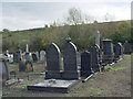
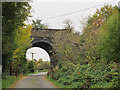
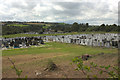
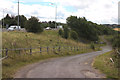
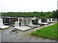
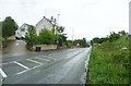
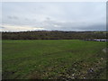
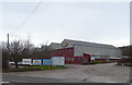
Photos of LS12 6NE


Area Information
LS12 6NE is a compact residential postcode in England, home to 2,797 people spread across a densely populated area of 905 people per square kilometre. This small cluster of homes is positioned near key transport links and retail hubs, making it a practical choice for those seeking convenience without sacrificing space. The area’s character is defined by its established community, with a median age of 47 and a population skewed towards adults aged 30–64. Daily life here balances proximity to urban amenities with the relative tranquillity of a residential neighbourhood. Residents benefit from nearby rail stations, including Cottingley and Morley, which connect to Leeds and beyond. The area’s proximity to supermarkets like Tesco Morley and Iceland Leeds Junction 1 ensures easy access to shopping, while the high broadband score of 96 supports seamless digital connectivity. For buyers, LS12 6NE offers a blend of stability and accessibility, ideal for those prioritising practicality and a mature community.
- Area Type
- Postcode
- Area Size
- Not available
- Population
- 2797
- Population Density
- 905 people/km²
The property market in LS12 6NE is characterised by a high rate of home ownership (76%), indicating a stable and long-term resident base. The accommodation type is predominantly houses, which suggests a focus on family-sized homes rather than apartments or flats. This makes the area appealing to buyers seeking spacious, private living environments. However, as a small postcode area, the housing stock is limited, meaning buyers may need to consider nearby neighbourhoods for a broader selection. The high home ownership rate also implies a competitive market, with properties likely retaining value due to their rarity. For those prioritising security and long-term investment, LS12 6NE’s housing stock offers a reliable option, though buyers should be mindful of the limited supply and potential price pressures.
House Prices in LS12 6NE
No properties found in this postcode.
Energy Efficiency in LS12 6NE
The lifestyle in LS12 6NE is shaped by its proximity to retail and transport hubs. Nearby supermarkets such as Makro Leeds, Iceland Leeds Junction 1, and Tesco Morley provide convenient access to groceries and daily essentials. While the area lacks detailed data on parks or leisure facilities, its rail connections and retail options suggest a practical, urban-oriented lifestyle. The compact nature of the postcode means amenities are within walking or short driving distance, reducing the need for long commutes. For residents, this balance of accessibility and limited local amenities creates a functional environment, ideal for those prioritising convenience over expansive recreational spaces.
Amenities
Schools
The only school listed near LS12 6NE is Core Training and Development Limited, an independent institution with an Ofsted rating of satisfactory. This school type typically offers specialised educational programmes or smaller class sizes, though the data does not specify its curriculum or student outcomes. The presence of an independent school may attract families seeking alternative educational options, but the lack of state schools in the immediate area means parents may need to look further afield for additional choices. The single school listed highlights a limited range of educational institutions, which could be a consideration for families prioritising school diversity.
| Rank | School | Type | Entry gender | Ages |
|---|
Explore more schools in this area
Go to Schools tabDemographics
The community in LS12 6NE is predominantly composed of adults aged 30–64, with a median age of 47. This suggests a settled population, likely with established careers and family ties to the area. Home ownership is high, with 76% of residents owning their homes, indicating a stable housing market. The accommodation type is primarily houses, reflecting a preference for family-oriented living spaces. The predominant ethnic group is White, which aligns with broader demographic trends in the region. While the data does not specify deprivation levels, the high home ownership rate and mature age profile suggest a community with strong economic foundations. However, the absence of detailed diversity metrics means the full range of cultural and social dynamics remains unexplored.
Household Size
Accommodation Type
Tenure
Ethnic Group
Religion
Household Composition
Age
Household Deprivation
NS-SEC
Explore more demographic insights in this area
Go to Demographics tabPlanning
Planning Constraints
- Flood RiskPremium
- Ramsar Wetland SitesPremium
- Area of Outstanding Natural BeautyPremium
- Protected Nature ReservePremium
- Protected WoodlandPremium