Area Overview for LS12 6LB
Photos of LS12 6LB

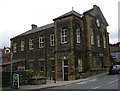
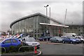
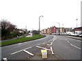
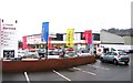

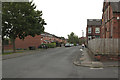
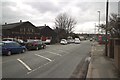
100 photos from this area
Area Information
Key information about the LS12 6LB including its size, population, and administrative classification.
- Area Type
- Postcode
- Area Size
- 1.6 hectares
- Population
- 2797
- Population Density
- 905 people/km²
House Prices in LS12 6LB
35
Properties
£131,468
Average Sold Price
£45,500
Lowest Price
£215,000
Highest Price
Showing 35 properties
| Address | Type | Beds | Baths | Last Sale Price | Last Sale Date | |
|---|---|---|---|---|---|---|
| 373 Whitehall Road, Leeds, LS12 6LB | Semi-detached | 3 | - | £175,000 | Mar 2025 | |
| 397 Whitehall Road, Leeds, LS12 6LB | Semi-detached | 3 | 1 | £215,000 | Jun 2024 | |
| 409 Whitehall Road, Leeds, LS12 6LB | house | 3 | 1 | £152,500 | Sep 2021 | |
| 347 Whitehall Road, Leeds, LS12 6LB | Bungalow | - | - | £180,000 | May 2021 | |
| 379 Whitehall Road, Leeds, LS12 6LB | Semi-detached | 3 | 1 | £182,000 | Jul 2020 | |
| 413 Whitehall Road, Leeds, LS12 6LB | house | - | - | £154,995 | Jan 2018 | |
| 407 Whitehall Road, Leeds, LS12 6LB | Semi-detached | 3 | - | £138,000 | Mar 2016 | |
| 393 Whitehall Road, Leeds, LS12 6LB | Semi-detached | 3 | 1 | £100,000 | Nov 2015 | |
| 419 Whitehall Road, Leeds, LS12 6LB | house | - | - | £95,000 | Nov 2013 | |
| 371 Whitehall Road, Leeds, LS12 6LB | Semi-detached | 3 | 1 | £114,000 | Mar 2013 |
Page 1 of 4
Energy Efficiency in LS12 6LB
Amenities
Schools
| Rank | School | Type | Entry gender | Ages |
|---|
Explore more schools in this area
Go to Schools tabDemographics
Household Size
Two person
most common
Accommodation Type
Houses
most common
Tenure
76
majority
Ethnic Group
White
most common
Religion
N/A
most common
Household Composition
N/A
most common
Age
47
median
Adults (30-64 years)
most common
Household Deprivation
N/A
with no deprivation
NS-SEC
41
in Lower managerial occupations
Explore more demographic insights in this area
Go to Demographics tabPlanning
Planning Constraints
- Flood RiskPremium
- Ramsar Wetland SitesPremium
- Area of Outstanding Natural BeautyPremium
- Protected Nature ReservePremium
- Protected WoodlandPremium