Area Overview for LS12 6JW
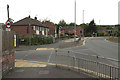
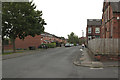
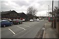
Photos of LS12 6JW


Area Information
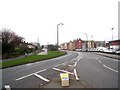
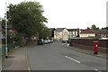
Living in LS12 6JW offers a compact, tightly knit residential experience within a small cluster of homes. The area covers 7,016 square metres and is home to 1,402 residents, creating a high population density of 199,822 people per square kilometre. This suggests a closely connected community where local amenities and services are likely within easy reach. The postcode is positioned in a way that balances urban proximity with a sense of seclusion, making it appealing to those seeking a quieter lifestyle without sacrificing access to essential services. Daily life here is shaped by the surrounding infrastructure, including nearby retail hubs and rail links, which support both practical needs and mobility. The presence of two primary schools within the area adds to its appeal for families, ensuring children have access to education without long commutes. While the area’s small size means it is not suited to large-scale development, it retains a distinct character that caters to those prioritising community cohesion and convenience over expansive living spaces.
- Area Type
- Postcode
- Area Size
- 7016 m²
- Population
- 1402
- Population Density
- 199822 people/km²
The property market in LS12 6JW is characterised by a high rate of home ownership, with 77% of residents living in owner-occupied homes. This suggests a community where long-term residency is the norm, and property is viewed as a stable investment. The accommodation types here are predominantly houses, which is unusual for a small postcode area but may indicate a mix of detached and semi-detached housing. This contrasts with areas where flats or apartments dominate, and it implies that LS12 6JW is not a high-density rental market. For buyers, this means the area is more likely to cater to those seeking a family home or a property with potential for long-term value. The limited size of the area means that the housing stock is relatively uniform, and buyers should consider the proximity to amenities and transport links as key factors. The high home ownership rate also suggests that the area is not heavily influenced by speculative investment, which could benefit those looking for a stable, low-risk purchase.
House Prices in LS12 6JW
No properties found in this postcode.
Energy Efficiency in LS12 6JW
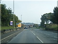
The lifestyle in LS12 6JW is supported by a range of nearby amenities, including retail and transport options. Within practical reach are five retail outlets, such as Makro Leeds, Asda Wortley, and Iceland Leeds Junction 1, offering a mix of supermarket and specialist shopping. These stores provide residents with access to everyday essentials, reducing the need for long trips to larger centres. The area’s rail connectivity is further enhanced by five nearby stations, including Cottingley and Leeds Railway Stations, which facilitate easy travel to other parts of the region. While the data does not specify parks or leisure facilities, the presence of schools and retail hubs suggests a community-oriented environment. The combination of retail accessibility and rail links makes LS12 6JW convenient for those prioritising practicality and ease of movement in their daily lives.
Amenities
Schools
Residents of LS12 6JW have access to two primary schools within the immediate area: Lower Wortley Primary School and Lower Wortley First School. Both institutions serve the local community, providing education for younger children without the need for long commutes. Lower Wortley Primary School holds an Ofsted rating of 'good', indicating a satisfactory standard of education with areas for improvement. The presence of two primary schools suggests a well-established educational infrastructure, which is particularly beneficial for families with young children. While no secondary schools are listed in the data, the proximity to primary education ensures that children can begin their schooling locally, reducing reliance on transport for early education. This makes LS12 6JW an attractive option for parents prioritising accessible schooling for their children.
| Rank | School | Type | Entry gender | Ages |
|---|
Explore more schools in this area
Go to Schools tabDemographics
The population of LS12 6JW is predominantly composed of adults aged 30–64, with a median age of 47. This suggests a mature, stable community with a focus on long-term residency. Home ownership is high, at 77%, indicating a strong presence of owner-occupied properties rather than rental units. The accommodation types here are primarily houses, which aligns with the area’s residential cluster model. The predominant ethnic group is White, reflecting a demographic profile that is consistent with broader regional trends. The age range and home ownership figures imply a neighbourhood where families and individuals in their middle years are likely to be the primary residents. This demographic profile may influence local services and amenities, with a focus on needs such as schools, healthcare, and community centres. The absence of specific data on deprivation levels means the area’s quality of life is inferred from its high home ownership and stable population structure, which often correlates with lower deprivation rates.
Household Size
Accommodation Type
Tenure
Ethnic Group
Religion
Household Composition
Age
Household Deprivation
NS-SEC
Explore more demographic insights in this area
Go to Demographics tabPlanning
Planning Constraints
- Flood RiskPremium
- Ramsar Wetland SitesPremium
- Area of Outstanding Natural BeautyPremium
- Protected Nature ReservePremium
- Protected WoodlandPremium