Area Overview for LS12 6AY
Photos of LS12 6AY


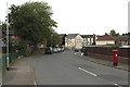
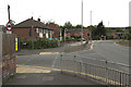
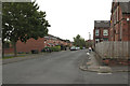
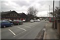
100 photos from this area
Area Information
Key information about the LS12 6AY including its size, population, and administrative classification.
- Area Type
- Postcode
- Area Size
- 2.7 hectares
- Population
- 2797
- Population Density
- 905 people/km²
House Prices in LS12 6AY
59
Properties
£129,484
Average Sold Price
£36,750
Lowest Price
£299,950
Highest Price
Showing 59 properties
| Address | Type | Beds | Baths | Last Sale Price | Last Sale Date | |
|---|---|---|---|---|---|---|
| 119 Kirkdale Crescent, Farnley, Leeds, LS12 6AY | Detached | 2 | 1 | £174,000 | Sep 2025 | |
| 23 Kirkdale Crescent, Farnley, Leeds, LS12 6AY | Semi-detached | 3 | 2 | £299,950 | Aug 2024 | |
| 83 Kirkdale Crescent, Farnley, Leeds, LS12 6AY | Semi-detached | 3 | 1 | £205,000 | Jul 2024 | |
| 51 Kirkdale Crescent, Farnley, Leeds, LS12 6AY | Semi-detached | 2 | 1 | £192,000 | Apr 2023 | |
| 73 Kirkdale Crescent, Farnley, Leeds, LS12 6AY | Semi-detached | 3 | 1 | £245,000 | Feb 2023 | |
| 47 Kirkdale Crescent, Farnley, Leeds, LS12 6AY | house | 3 | - | £190,000 | Nov 2021 | |
| 25 Kirkdale Crescent, Farnley, Leeds, LS12 6AY | house | - | - | £159,995 | Oct 2021 | |
| 9 Kirkdale Crescent, Farnley, Leeds, LS12 6AY | house | - | - | £155,000 | Feb 2021 | |
| 37 Kirkdale Crescent, Farnley, Leeds, LS12 6AY | Semi-detached | 3 | 1 | £153,700 | Dec 2020 | |
| 53 Kirkdale Crescent, Farnley, Leeds, LS12 6AY | house | - | - | £164,000 | Aug 2020 |
Page 1 of 6
Energy Efficiency in LS12 6AY
Amenities
Schools
| Rank | School | Type | Entry gender | Ages |
|---|
Explore more schools in this area
Go to Schools tabDemographics
Household Size
Two person
most common
Accommodation Type
Houses
most common
Tenure
76
majority
Ethnic Group
White
most common
Religion
N/A
most common
Household Composition
N/A
most common
Age
47
median
Adults (30-64 years)
most common
Household Deprivation
N/A
with no deprivation
NS-SEC
41
in Lower managerial occupations
Explore more demographic insights in this area
Go to Demographics tabPlanning
Planning Constraints
- Flood RiskPremium
- Ramsar Wetland SitesPremium
- Area of Outstanding Natural BeautyPremium
- Protected Nature ReservePremium
- Protected WoodlandPremium