Area Overview for LS12 1UY
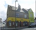
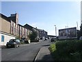
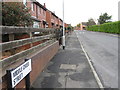
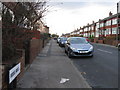
Photos of LS12 1UY


Area Information
LS12 1UY is a small residential postcode area in England, home to just 1956 people. It is a compact cluster of properties, likely centred around a specific development or street. The area’s demographic profile suggests a mature community, with a median age of 47 and the majority of residents falling within the 30-64 age range. This indicates a population that is largely in or nearing middle age, with a focus on established households. Living here offers proximity to essential services, including retail outlets, rail networks, and nearby airports. The area’s small size means it is likely to feel tight-knit, though the low home ownership rate (15%) suggests a significant portion of the population may be renters. The presence of primary schools and a range of local amenities within practical reach adds to the practicality of daily life. While the area is not large, its accessibility to transport hubs and retail options makes it a viable choice for those prioritising convenience over expansive space.
- Area Type
- Postcode
- Area Size
- Not available
- Population
- 1956
- Population Density
- 6785 people/km²
The property market in LS12 1UY is characterised by a low home ownership rate of 15%, suggesting that the majority of properties are rented rather than owner-occupied. This points to a rental market that may be more prominent than a buyers’ market, particularly in a small area where housing stock is limited. The predominant accommodation type is flats, which is typical for smaller residential clusters and may indicate a focus on multi-unit developments or converted buildings. For buyers, this means the area is unlikely to offer a large selection of owner-occupied homes, and competition for available properties could be fierce. The small size of the area also means that the immediate surroundings are likely to be similarly structured, with limited scope for expansion or new developments. Potential buyers should consider the practical implications of a rental-heavy market and the likelihood of limited property choice.
House Prices in LS12 1UY
No properties found in this postcode.
Energy Efficiency in LS12 1UY
The lifestyle in LS12 1UY is supported by a range of nearby amenities, including retail outlets such as Heron Armley, Tesco Armley, and Morrisons Daily. These shops provide access to essential goods and services, enhancing daily convenience. The area’s proximity to rail stations like Burley Park and Leeds Railway Station ensures easy travel for work, shopping, or leisure. The presence of two airports nearby adds to the area’s accessibility, particularly for those requiring regular air travel. While the data does not specify parks or leisure facilities, the availability of retail and transport options suggests a practical, functional lifestyle. The compact nature of the area means that amenities are likely to be within walking or short driving distance, contributing to a convenient, though possibly limited, range of recreational or leisure opportunities.
Amenities
Schools
Residents of LS12 1UY have access to three primary schools within practical reach: St Bartholomew’s CofE Voluntary Controlled Primary School, which holds an Ofsted rating of 'good', and St Bartholomew’s CofE First School, which is also a primary school but lacks an Ofsted rating. Armley Middle School is another primary school in the area, though its rating is not specified. The presence of multiple primary schools suggests a focus on early education, which is beneficial for families with young children. However, the absence of secondary school data means that parents may need to look further afield for secondary education. The availability of at least two primary schools with a 'good' rating offers reassurance for families prioritising quality education, though the lack of detailed ratings for all schools means further research may be necessary for a complete picture.
| Rank | School | Type | Entry gender | Ages |
|---|
Explore more schools in this area
Go to Schools tabDemographics
The population of LS12 1UY is 1956, with a median age of 47. This places the area squarely within the adult demographic, with 30-64-year-olds forming the most common age group. Home ownership is low, at just 15%, indicating that the majority of residents are likely to be renting. The predominant accommodation type is flats, which aligns with the small scale of the area and the likelihood of shared or multi-unit developments. The predominant ethnic group is White, though no specific data on diversity or deprivation is provided. The low home ownership rate may suggest a transient population or a reliance on rental housing, which could influence the local community’s dynamics. The age profile implies a population that is largely settled, with fewer young families or elderly residents compared to other areas.
Household Size
Accommodation Type
Tenure
Ethnic Group
Religion
Household Composition
Age
Household Deprivation
NS-SEC
Explore more demographic insights in this area
Go to Demographics tabPlanning
Planning Constraints
- Flood RiskPremium
- Ramsar Wetland SitesPremium
- Area of Outstanding Natural BeautyPremium
- Protected Nature ReservePremium
- Protected WoodlandPremium