Area Overview for LS11 8EF
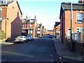
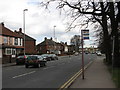
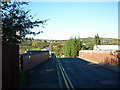
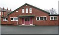
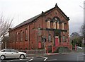
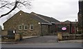
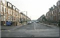
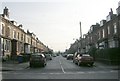
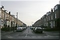
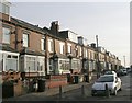
Photos of LS11 8EF


Area Information
Living in LS11 8EF means being part of a small, tightly knit residential cluster in England, home to 1,776 residents. This area is characterised by its compact size and proximity to essential services, making it practical for daily life. The community is predominantly composed of adults aged 30–64, with a median age of 47, reflecting a mature demographic. While the area is not large, its accessibility to nearby amenities and transport links ensures a balance between seclusion and connectivity. Residents benefit from proximity to Cottingley Railway Station and Morley Railway Station, which provide links to Leeds and beyond. The presence of multiple primary schools, including Cottingley Primary Academy with a good Ofsted rating, supports families seeking quality education. However, the area’s small size means it is not suited to those requiring expansive living spaces or extensive greenery. For those prioritising convenience and a straightforward lifestyle, LS11 8EF offers a functional base with minimal commute times to urban centres.
- Area Type
- Postcode
- Area Size
- Not available
- Population
- 1776
- Population Density
- 3514 people/km²
The property market in LS11 8EF is shaped by its small size and low home ownership rate of 29%. This suggests a limited number of owner-occupied homes, with a higher proportion of rental properties. The accommodation type is primarily houses, which may indicate a preference for single-family homes over apartments or terraced housing. Given the area’s compact nature, the housing stock is unlikely to be extensive, and buyers should consider the proximity to nearby amenities and transport links when evaluating properties. The low home ownership rate could reflect a transient population or a reliance on rental markets for housing. For those seeking to purchase, the limited availability of homes may mean competition for properties in this area, particularly those near schools or transport hubs.
House Prices in LS11 8EF
No properties found in this postcode.
Energy Efficiency in LS11 8EF
The lifestyle in LS11 8EF is shaped by its proximity to retail and transport hubs. Nearby amenities include Asda Beeston, M&S Marks and Spencer, and Iceland Leeds Junction 1, offering a range of shopping and grocery options. These retail outlets provide convenience for daily errands and household needs. The area’s rail network, with stations at Cottingley, Morley, and Leeds, ensures easy access to urban centres for work, leisure, or socialising. While there is no mention of parks or recreational spaces in the data, the presence of multiple schools and retail options suggests a community focused on practicality and accessibility. The compact nature of LS11 8EF means residents can reach essential services quickly, though larger leisure facilities may require travel to nearby towns.
Amenities
Schools
Residents of LS11 8EF have access to several educational institutions, including Cottingley Primary School, Cottingley First School, and Cottingley Primary Academy, which holds a good Ofsted rating. These primary schools cater to younger children, offering a range of educational options. The area also includes Cardinal Square School, a special school, and The Stephen Longfellow Academy, which serves a broader educational purpose. The presence of both mainstream and specialist schools provides families with flexibility in choosing education for their children. However, no secondary schools are listed in the data, meaning older students may need to travel to nearby areas for further education. The mix of school types ensures that families with diverse needs can find suitable options within the immediate vicinity.
| Rank | School | Type | Entry gender | Ages |
|---|
Explore more schools in this area
Go to Schools tabDemographics
The population of LS11 8EF is 1,776, with a median age of 47, indicating a community largely composed of middle-aged adults. The most common age range is 30–64 years, suggesting a stable, established population. Home ownership stands at 29%, which is relatively low, pointing to a mix of rental and owner-occupied properties. The predominant accommodation type is houses, though the exact proportion of flats or other dwellings is not specified. The predominant ethnic group is White, with no data provided on other ethnicities. This demographic profile implies a community focused on long-term residency rather than transient populations. The absence of specific data on deprivation or socioeconomic status means quality of life factors such as access to services or employment opportunities cannot be assessed from this dataset alone.
Household Size
Accommodation Type
Tenure
Ethnic Group
Religion
Household Composition
Age
Household Deprivation
NS-SEC
Explore more demographic insights in this area
Go to Demographics tabPlanning
Planning Constraints
- Flood RiskPremium
- Ramsar Wetland SitesPremium
- Area of Outstanding Natural BeautyPremium
- Protected Nature ReservePremium
- Protected WoodlandPremium