Area Overview for LS11 7EY
Photos of LS11 7EY
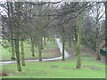
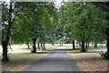
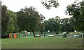
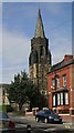
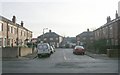
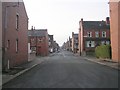
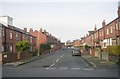
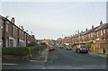
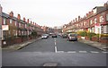
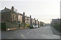
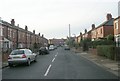
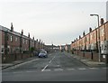
100 photos from this area
Area Information
Key information about the LS11 7EY including its size, population, and administrative classification.
- Area Type
- Postcode
- Area Size
- 2959 m²
- Population
- 1790
- Population Density
- 5923 people/km²
House Prices in LS11 7EY
16
Properties
£94,136
Average Sold Price
£31,000
Lowest Price
£165,000
Highest Price
Showing 16 properties
| Address | Type | Beds | Baths | Last Sale Price | Last Sale Date | |
|---|---|---|---|---|---|---|
| 64 Grovehall Road, Beeston, Leeds, LS11 7EY | Detached | 3 | 1 | £165,000 | Nov 2024 | |
| 36 Grovehall Road, Beeston, Leeds, LS11 7EY | house | - | - | £135,000 | Apr 2021 | |
| 62 Grovehall Road, Beeston, Leeds, LS11 7EY | house | - | - | £100,000 | Oct 2017 | |
| 52 Grovehall Road, Beeston, Leeds, LS11 7EY | Terraced | 3 | 1 | £93,000 | Feb 2017 | |
| 38 Grovehall Road, Beeston, Leeds, LS11 7EY | Terraced | 3 | 1 | £102,000 | Dec 2016 | |
| 56 Grovehall Road, Beeston, Leeds, LS11 7EY | Terraced | 3 | - | £70,000 | Aug 2013 | |
| 42 Grovehall Road, Beeston, Leeds, LS11 7EY | Terraced | 3 | - | £82,000 | Sep 2012 | |
| 50 Grovehall Road, Beeston, Leeds, LS11 7EY | house | - | - | £95,000 | Apr 2010 | |
| 46 Grovehall Road, Beeston, Leeds, LS11 7EY | Terraced | - | - | £83,500 | Dec 2003 | |
| 60 Grovehall Road, Beeston, Leeds, LS11 7EY | Terraced | - | - | £79,000 | Aug 2003 |
Page 1 of 2
Energy Efficiency in LS11 7EY
Amenities
Schools
| Rank | School | Type | Entry gender | Ages |
|---|
Explore more schools in this area
Go to Schools tabDemographics
Household Size
Family (3-5 people)
most common
Accommodation Type
Houses
most common
Tenure
73
majority
Ethnic Group
White
most common
Religion
N/A
most common
Household Composition
N/A
most common
Age
47
median
Adults (30-64 years)
most common
Household Deprivation
N/A
with no deprivation
NS-SEC
22
in Lower managerial occupations
Explore more demographic insights in this area
Go to Demographics tabPlanning
Planning Constraints
- Flood RiskPremium
- Ramsar Wetland SitesPremium
- Area of Outstanding Natural BeautyPremium
- Protected Nature ReservePremium
- Protected WoodlandPremium