Area Overview for LS11 6HA
Photos of LS11 6HA
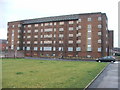
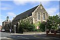
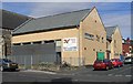

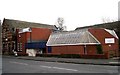
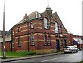
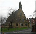
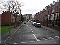
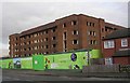
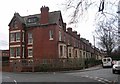
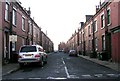
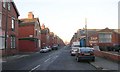
100 photos from this area
Area Information
Key information about the LS11 6HA including its size, population, and administrative classification.
- Area Type
- Postcode
- Area Size
- 5889 m²
- Population
- 1750
- Population Density
- 15351 people/km²
House Prices in LS11 6HA
59
Properties
£81,481
Average Sold Price
£20,000
Lowest Price
£125,000
Highest Price
Showing 59 properties
| Address | Type | Beds | Baths | Last Sale Price | Last Sale Date | |
|---|---|---|---|---|---|---|
| 5 Linden Road, Beeston, Leeds, LS11 6HA | Terraced | 4 | 1 | £101,250 | Mar 2024 | |
| 18 Linden Road, Beeston, Leeds, LS11 6HA | Terraced | 4 | - | £125,000 | Feb 2022 | |
| 24 Linden Road, Beeston, Leeds, LS11 6HA | house | - | - | £110,000 | Nov 2021 | |
| 13 Linden Road, Beeston, Leeds, LS11 6HA | Terraced | 4 | 1 | £115,000 | Jun 2020 | |
| 46 Linden Road, Beeston, Leeds, LS11 6HA | Terraced | 1 | 1 | £84,000 | Oct 2014 | |
| 14 Linden Road, Beeston, Leeds, LS11 6HA | house | - | - | £120,000 | Nov 2007 | |
| 17 Linden Road, Beeston, Leeds, LS11 6HA | house | - | - | £30,000 | Jul 2006 | |
| 2 Linden Road, Beeston, Leeds, LS11 6HA | Terraced | 4 | 3 | £85,000 | May 2006 | |
| 28 Linden Road, Beeston, Leeds, LS11 6HA | house | - | - | £73,000 | Nov 2005 | |
| 12 Linden Road, Beeston, Leeds, LS11 6HA | house | - | - | £88,000 | Nov 2005 |
Page 1 of 6
Energy Efficiency in LS11 6HA
Amenities
Schools
| Rank | School | Type | Entry gender | Ages |
|---|
Explore more schools in this area
Go to Schools tabDemographics
Household Size
Family (3-5 people)
most common
Accommodation Type
Houses
most common
Tenure
25
majority
Ethnic Group
asian_total
most common
Religion
N/A
most common
Household Composition
N/A
most common
Age
22
median
Adults (30-64 years)
most common
Household Deprivation
N/A
with no deprivation
NS-SEC
11
in Lower managerial occupations
Explore more demographic insights in this area
Go to Demographics tabPlanning
Planning Constraints
- Flood RiskPremium
- Ramsar Wetland SitesPremium
- Area of Outstanding Natural BeautyPremium
- Protected Nature ReservePremium
- Protected WoodlandPremium