Area Overview for LS11 0LB
Photos of LS11 0LB
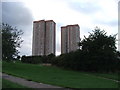
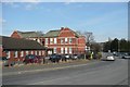
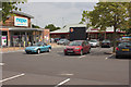
100 photos from this area
Area Information
Key information about the LS11 0LB including its size, population, and administrative classification.
- Area Type
- Postcode
- Area Size
- 1.0 hectares
- Population
- 1552
- Population Density
- 2215 people/km²
House Prices in LS11 0LB
42
Properties
£90,496
Average Sold Price
£23,500
Lowest Price
£167,000
Highest Price
Showing 42 properties
| Address | Type | Beds | Baths | Last Sale Price | Last Sale Date | |
|---|---|---|---|---|---|---|
| 32 Dulverton Place, Beeston, Leeds, LS11 0LB | Terraced | 3 | 1 | £145,000 | Apr 2024 | |
| 54 Dulverton Place, Beeston, Leeds, LS11 0LB | Terraced | 4 | 1 | £167,000 | Apr 2024 | |
| 66 Dulverton Place, Beeston, Leeds, LS11 0LB | Terraced | 2 | 2 | £125,000 | Nov 2023 | |
| 84 Dulverton Place, Beeston, Leeds, LS11 0LB | house | - | - | £140,000 | Aug 2022 | |
| 38 Dulverton Place, Beeston, Leeds, LS11 0LB | house | 1 | - | £56,500 | Aug 2021 | |
| 2 Dulverton Place, Beeston, Leeds, LS11 0LB | house | - | - | £92,000 | Jan 2021 | |
| 14 Dulverton Place, Beeston, Leeds, LS11 0LB | Terraced | 3 | 1 | £81,500 | Mar 2018 | |
| 50 Dulverton Place, Beeston, Leeds, LS11 0LB | Terraced | 2 | 1 | £50,500 | May 2014 | |
| 56 Dulverton Place, Beeston, Leeds, LS11 0LB | house | 4 | - | £60,000 | Apr 2011 | |
| 80 Dulverton Place, Beeston, Leeds, LS11 0LB | Terraced | 3 | - | £115,000 | Dec 2007 |
Page 1 of 5
Energy Efficiency in LS11 0LB
Amenities
Schools
| Rank | School | Type | Entry gender | Ages |
|---|
Explore more schools in this area
Go to Schools tabDemographics
Household Size
Family (3-5 people)
most common
Accommodation Type
Houses
most common
Tenure
29
majority
Ethnic Group
White
most common
Religion
N/A
most common
Household Composition
N/A
most common
Age
47
median
Adults (30-64 years)
most common
Household Deprivation
N/A
with no deprivation
NS-SEC
15
in Lower managerial occupations
Explore more demographic insights in this area
Go to Demographics tabPlanning
Planning Constraints
- Flood RiskPremium
- Ramsar Wetland SitesPremium
- Area of Outstanding Natural BeautyPremium
- Protected Nature ReservePremium
- Protected WoodlandPremium