Area Overview for LS11 0JD
Photos of LS11 0JD
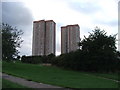
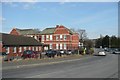
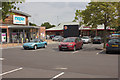
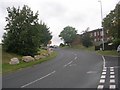
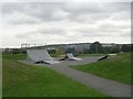
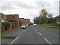
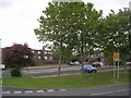
100 photos from this area
Area Information
Key information about the LS11 0JD including its size, population, and administrative classification.
- Area Type
- Postcode
- Area Size
- 6833 m²
- Population
- 1776
- Population Density
- 3514 people/km²
House Prices in LS11 0JD
29
Properties
£79,849
Average Sold Price
£29,000
Lowest Price
£170,000
Highest Price
Showing 29 properties
| Address | Type | Beds | Baths | Last Sale Price | Last Sale Date | |
|---|---|---|---|---|---|---|
| 50 Cottingley Green, Beeston, Leeds, LS11 0JD | Terraced | 3 | 1 | £170,000 | Jul 2025 | |
| 28 Cottingley Green, Beeston, Leeds, LS11 0JD | Terraced | 3 | 1 | £130,000 | Jun 2024 | |
| 54 Cottingley Green, Beeston, Leeds, LS11 0JD | Terraced | 2 | 1 | £91,000 | Aug 2019 | |
| 32 Cottingley Green, Beeston, Leeds, LS11 0JD | Terraced | 3 | 1 | £93,000 | Jul 2017 | |
| 30 Cottingley Green, Beeston, Leeds, LS11 0JD | Terraced | 3 | - | £76,000 | Jul 2014 | |
| 52 Cottingley Green, Beeston, Leeds, LS11 0JD | house | - | - | £62,500 | Apr 2014 | |
| 34 Cottingley Green, Beeston, Leeds, LS11 0JD | Terraced | 3 | - | £79,995 | Mar 2010 | |
| 20 Cottingley Green, Beeston, Leeds, LS11 0JD | Terraced | 3 | - | £29,000 | Sep 2000 | |
| 56 Cottingley Green, Beeston, Leeds, LS11 0JD | Terraced | - | - | £34,995 | Jun 2000 | |
| 4 Cottingley Green, Beeston, Leeds, LS11 0JD | Terraced | - | - | £32,000 | Oct 1996 |
Page 1 of 3
Energy Efficiency in LS11 0JD
Amenities
Schools
| Rank | School | Type | Entry gender | Ages |
|---|
Explore more schools in this area
Go to Schools tabDemographics
Household Size
One person
most common
Accommodation Type
Houses
most common
Tenure
29
majority
Ethnic Group
White
most common
Religion
N/A
most common
Household Composition
N/A
most common
Age
47
median
Adults (30-64 years)
most common
Household Deprivation
N/A
with no deprivation
NS-SEC
16
in Lower managerial occupations
Explore more demographic insights in this area
Go to Demographics tabPlanning
Planning Constraints
- Flood RiskPremium
- Ramsar Wetland SitesPremium
- Area of Outstanding Natural BeautyPremium
- Protected Nature ReservePremium
- Protected WoodlandPremium