Area Overview for LS1 2RW
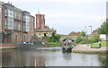
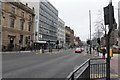
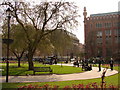
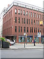
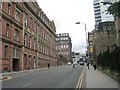
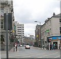
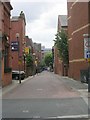
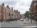
Photos of LS1 2RW


Area Information
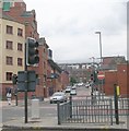
Living in LS1 2RW means being part of a small, tightly knit residential cluster in England’s north. With a population of just over 2,000 people, this area is compact but well-connected, positioned near key transport hubs. The community is notably young, with a median age of 22 and the majority of residents aged between 15 and 29. This demographic suggests a dynamic, often student or early-career-oriented environment. The area’s housing stock is dominated by flats, reflecting its density and likely appeal to renters. While the population is small, the proximity to Leeds Railway Station and nearby retail hubs like M&S Leeds and Tesco St Pauls ensures daily life is convenient. However, the area’s crime risk is high, with a safety score of just 1/100, which prospective buyers should consider. Despite this, flood risk is minimal, and the absence of protected natural sites means development constraints are low. For those prioritising accessibility and affordability, LS1 2RW offers a compact, practical living option in a city-centre context.
- Area Type
- Postcode
- Area Size
- Not available
- Population
- Not available
- Population Density
- Not available
The property market in LS1 2RW is characterised by a very low home ownership rate—just 19% of residents own their homes. This suggests the area is predominantly a rental market, with flats making up the majority of accommodation types. The small population and compact nature of the postcode mean the housing stock is limited, likely concentrated around a few key buildings or developments. For buyers, this presents challenges: the area is not a traditional owner-occupied neighbourhood, and the scarcity of available properties may make purchasing difficult. However, the proximity to Leeds Railway Station and major retail hubs like Tesco Leeds could be selling points for investors or those seeking short-term rental opportunities. Given the high crime risk and young demographic, property values may reflect the area’s practical, rather than aspirational, appeal.
House Prices in LS1 2RW
No properties found in this postcode.
Energy Efficiency in LS1 2RW
Daily life in LS1 2RW is shaped by its proximity to retail and transport hubs. Within walking distance are major supermarkets like Tesco Leeds and Tesco St Pauls, as well as M&S Leeds, providing convenience for shopping and essentials. The area’s rail links—Leeds Railway Station, Burley Park, and Headingley—offer easy access to the city’s cultural, professional, and educational offerings. While the data does not mention parks or leisure facilities directly, the absence of protected natural sites suggests limited green space. The retail and transport infrastructure, however, contribute to a practical, urban lifestyle. For residents, the balance of shops, transport, and proximity to Leeds makes LS1 2RW a functional base, though its small size means amenities are not extensive.
Amenities
Schools
| Rank | School | Type | Entry gender | Ages |
|---|
Explore more schools in this area
Go to Schools tabDemographics
The community in LS1 2RW is overwhelmingly young, with a median age of 22 and the majority of residents falling within the 15–29 age bracket. This suggests a population skewed towards students, graduates, and young professionals. Home ownership is exceptionally low at 19%, indicating that most residents rent their accommodation. The predominant housing type is flats, which aligns with the area’s small scale and likely focus on rental properties. The predominant ethnic group is White, though specific data on diversity beyond this is not provided. The low home ownership rate and young age profile imply a transient population, possibly influenced by nearby educational institutions or employment opportunities. For quality of life, the high proportion of renters and young residents may mean a more fluid social environment, but the lack of data on deprivation or income levels means broader socioeconomic context remains unclear.
Household Size
Accommodation Type
Tenure
Ethnic Group
Religion
Household Composition
Age
Household Deprivation
NS-SEC
Explore more demographic insights in this area
Go to Demographics tabPlanning
Planning Constraints
- Flood RiskPremium
- Ramsar Wetland SitesPremium
- Area of Outstanding Natural BeautyPremium
- Protected Nature ReservePremium
- Protected WoodlandPremium