Area Overview for Liversedge and Gomersal Ward
Photos of Liversedge and Gomersal Ward
Area Information
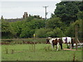
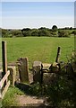
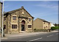
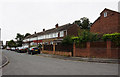
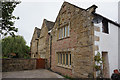
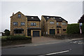
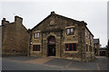
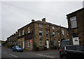
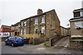
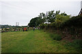
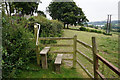
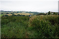
Liversedge and Gomersal Ward occupies 13.0 km² of land within the Kirklees metropolitan borough in West Yorkshire. This electoral ward combines the industrial heritage of the town of Liversedge with the village of Gomersal. They sit between Cleckheaton and Heckmondwike as part of the historic Heavy Woollen District. You will find Christ Church, Liversedge, which was built between 1812 and 1816, standing as a significant local landmark alongside the Town Hall on Knowler Hill. The area has deep industrial roots, having been involved in woollen manufacture since the 15th century under the Neville family. Significant development occurred in the 19th century, though the area faced the Luddite movement with a major attack on Rawfolds Mill in 1812. Sparrow Park, which opened in 2012, now commemorates this event near the operational Shears pub. Residents here experience daily life shaped by this unique blend of industrial history and village green space. The ward manages to offer housing options for those seeking proximity to historic sites like the National School established around 1818. You are living in a distinct community defined by its specific local government boundaries and rich past.
- Area Type
- District Borough Unitary Ward
- Area Size
- 13.0 km²
- Population
- Not available
- Population Density
- Not available
Demographics
The community within Liversedge and Gomersal Ward has a high median age of 70. Most residents fall into an older demographic profile compared to national averages. You should note that 69% of households in this area own their homes outright or have a mortgage. This suggests the ward is primarily an owner-occupied market rather than a rental sector. The data indicates the total population age distribution rather than specific breakdowns for younger families. Household composition and accommodation types are recorded in the total category, meaning no single dwelling style dominates exclusively. The ethnicity and religion data are not broken down into specific dominant groups within the provided summary. Still, the high home ownership rate points towards a settled population likely retiring or already living in the area for decades. Deprivation levels are not explicitly quantified in the current dataset, but the age profile suggests a retirement or older worker demographic. If you are considering homes in Liversedge and Gomersal Ward, you are looking at an area with significant senior citizen residency. This demographic reality influences local amenities and the pace of community life.
Household Size
Accommodation Type
Tenure
Ethnic Group
Religion
Household Composition
Age
Household Deprivation
NS-SEC
Explore more demographic insights in this area
Go to Demographics tabPlanning
Planning Constraints
- Flood RiskPremium
- Ramsar Wetland SitesPremium
- Area of Outstanding Natural BeautyPremium
- Protected Nature ReservePremium
- Protected WoodlandPremium
- Crime RiskPremium