Middle Farm, east of Langton in Langton
East of Langton in Langton
Hedge on Cordike Fields in Langton
Boundary wall of Langton Hall and view across the valley of the Langton Beck in Langton
Cordike Lane near Langton  in Langton
Farm track to Langton in Langton
Road passing Middle Farm in Langton
Wall along Cordike Lane in Langton
Cordike Lane approaching Langton in Langton
Farmland east of Langton in Langton
Farm buildings at Langton Hall in Langton
Middle Farm on Cordike Lane in Langton
25 photos from this area

Area Information

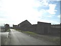
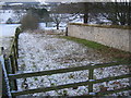
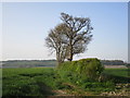
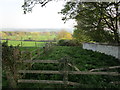
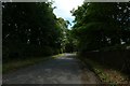
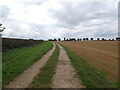
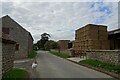
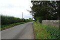
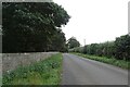
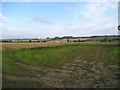
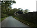
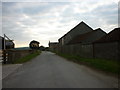
Langton is a small civil parish located in North Yorkshire, covering an area of 9.2 km². This village sits approximately 3.5 miles south of the market town of Malton, within the broader landscape of what was the East Riding of Yorkshire. Although it was once part of the Ryedale district, it now falls under the administration of North Yorkshire Council. The community maintains a quiet, historic atmosphere centred around Langton Hall and St Andrew's Church. Historical records describe the location as a pretty village nestled in a Wolds valley, a character that persists today. While the population is officially recorded as under 100 people in the 2011 Census, the presence of a community primary school serving around 80 pupils indicates a small but active settlement. Local geography includes the Grade II listed Langton Hall, which previously housed Woodleigh School and later served as a seat for the Norcliffe family. Visitors may recognise the hall from its use in television productions such as *Gentleman Jack* and *Rich House Poor House*. The village offers a grounded rural experience defined by cottages and ancient monuments rather than modern development. For anyone considering living in Langton, the setting provides a distinct slice of country life surrounded by significant local history.

Area Type
Parish
Area Size
9.2 km²
Population
Not available
Population Density
Not available

Demographics

The community within Langton reflects a clear demographic profile suited to rural living. Census data indicates a median age of 70, meaning half the population is older than this figure. This age distribution aligns with the village's quiet atmosphere and traditional character. Household composition data is recorded as total, while accommodation types are similarly categorised as total in the available records. Home ownership stands at 51% of residents, suggesting that slightly more than half of the homes in Langton are occupied by their owners. Population diversity shows that the predominant ethnic group is total, indicating a homogenous community consistent with its rural setting. Religious affiliation is listed as total in the provided statistics. Although specific deprivation indices are not included in the dataset, the low crime risk score of 90 out of 100 suggests high safety standards. Local life revolves around the immediate village, with social interactions likely tied to the community primary school and local landmarks. The most common age range encompasses the broader total population, reinforcing the presence of older residents who have built long-term roots in the parish.

Household Size

total
most common

Accommodation Type

total
most common

Tenure

51
majority

Ethnic Group

total
most common

Religion

total
most common

Household Composition

total
most common

Age

70
median
Age: Total
most common

Household Deprivation

N/A
with no deprivation

NS-SEC

34
in Lower managerial occupations

Explore more demographic insights in this area

Go to Demographics tab

Planning

Planning Constraints

  • Flood Risk
    Premium
  • Ramsar Wetland Sites
    Premium
  • Area of Outstanding Natural Beauty
    Premium
  • Protected Nature Reserve
    Premium
  • Protected Woodland
    Premium
  • Crime Risk
    Premium

Explore more planning insights in this area

Open Planning map

Frequently Asked Questions

Who typically lives in Langton and what is the community like?
Residents in Langton are older, with a median age of 70, reflecting a stable rural population. The village is home to under 100 people according to the 2011 Census, yet it supports a community primary school with around 80 pupils. Home ownership sits at 51%, showing a balance between owner-occupiers and renters. The predominantly total ethnic group and religious statistics point to a homogeneous community centred around historic landmarks like St Andrew's Church and Langton Hall.
How are transport links and mobile connectivity in Langton?
Langton has no railway station, but Malton is only 3 miles north, offering a 40-minute train journey to York and a 2-hour trip to London. The mobile coverage score is 81 out of 100, which represents a good standard for digital services. This reliability ensures that working from home is feasible for many residents. While public transport is limited to the road network, the proximity to Malton provides essential access to larger retail and employment hubs for those commuting from the 9.2 km² parish.
Is Langton a safe place to live regarding crime and environmental risks?
Safety is high in Langton, with a crime risk score of 90 out of 100. This score indicates below-average crime rates compared to other areas, making it a secure neighbourhood. Flood risk is also low, recorded at a score of 4.56 out of 100. The parish has no Ramsar wetland sites or protected woodland constraints, meaning environmental planning restrictions are minimal. These factors combine to create a stable home environment where residents face few external safety threats.
What is the housing situation and prevalence of ownership in Langton?
Approximately 51% of homes in Langton are owned by their residents, suggesting a market driven by buyers rather than large-scale tenant leases. Accommodation types are recorded as total in the data, but the village features traditional cottages and the notable Langton Hall. The lack of data on rental properties implies a steady ownership base. With a median age of 70, the housing stock likely caters to established residents rather than young professionals or students, though the community school brings some family presence to the village.

We use cookies to provide you with the best experience. By continuing, you agree to our Cookie Policy .