Area Overview for LA6 3WZ
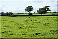
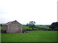
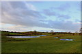
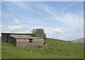
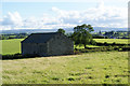
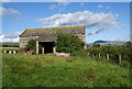
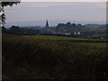
Photos of LA6 3WZ


Area Information
Living in LA6 3WZ offers a quiet, residential experience within a small cluster of homes. With a population of 1,906 and a density of 54 people per square kilometre, this area feels uncluttered, ideal for those seeking a slower pace of life. The community is predominantly composed of adults aged 30–64, many of whom own their homes. This demographic suggests a stable, established neighbourhood where long-term residency is common. Daily life is shaped by proximity to local amenities, including shops and rail links, while the absence of major environmental constraints means residents can enjoy a straightforward lifestyle. LA6 3WZ is not a sprawling suburb but a compact, self-contained area where familiarity with neighbours and local routines is likely. The presence of schools and low crime rates further reinforces its appeal as a family-friendly location, though its small size means it is best suited to those prioritising convenience over extensive urban offerings.
- Area Type
- Postcode
- Area Size
- Not available
- Population
- 1906
- Population Density
- 54 people/km²
The property market in LA6 3WZ is dominated by owner-occupied homes, with 84% of residents living in properties they own. This high level of home ownership suggests a community of long-term residents rather than a transient rental market. The accommodation type is primarily houses, which is typical for areas with lower population density and a focus on family living. Given the small size of the area, the number of available properties is limited, making it a niche market for buyers seeking a specific type of home. The predominance of houses may also indicate a preference for larger properties with gardens, which could be appealing to those prioritising space. However, the limited supply means competition for available homes is likely, and buyers should consider the area’s proximity to nearby towns for additional options.
House Prices in LA6 3WZ
No properties found in this postcode.
Energy Efficiency in LA6 3WZ
Residents of LA6 3WZ benefit from nearby amenities that cater to daily needs. The area includes five retail outlets, such as Co-op Ingleton, Asda Ingleton, and Spar, providing access to groceries, fuel, and general goods. These shops are within practical reach, reducing the need for long trips to larger centres. The three railway stations—Bentham, Wennington, and Clapham—offer connections to nearby towns, enhancing mobility for shopping, work, or socialising. While the area lacks large leisure facilities, the proximity to rail links and local shops ensures a convenient lifestyle. The small cluster of amenities reflects the area’s focus on simplicity and self-sufficiency, making it suitable for those who prioritise ease of access over extensive urban offerings. The presence of schools and low crime rates further contributes to a balanced, community-oriented environment.
Amenities
Schools
Residents of LA6 3WZ have access to a range of schools, including special and primary institutions. Cedar House School and Stonegate School are both special schools with Ofsted ratings of ‘good’, offering tailored support for students with specific needs. For younger children, Low Bentham Community Primary School and Richard Thornton’s Church of England Voluntary Aided Primary School provide primary education. The mix of school types ensures families can find options that match their children’s requirements, whether for mainstream or specialist education. This diversity is particularly beneficial for parents seeking a comprehensive educational environment. The presence of multiple schools within practical reach reduces the need for long commutes, enhancing the area’s appeal for families. The ‘good’ Ofsted ratings for the special schools indicate a standard of care and teaching that meets or exceeds national benchmarks.
| Rank | School | Type | Entry gender | Ages |
|---|
Explore more schools in this area
Go to Schools tabDemographics
The population of LA6 3WZ is 1,906, with a median age of 47, indicating a mature community where most residents are in their mid-40s or older. The majority of residents fall within the 30–64 age range, suggesting a focus on established families and professionals. Home ownership is high at 84%, reflecting a preference for long-term investment in property rather than rental living. The area is characterised by houses rather than flats, which aligns with the demographic’s likely need for more space. The predominant ethnic group is White, though no specific data on diversity is provided. The age profile implies a community with fewer young children and teenagers, which may influence local services and amenities. For buyers, this suggests a market where properties are likely to be family homes rather than starter flats, and where demand is driven by those seeking stability and a low-risk environment.
Household Size
Accommodation Type
Tenure
Ethnic Group
Religion
Household Composition
Age
Household Deprivation
NS-SEC
Explore more demographic insights in this area
Go to Demographics tabPlanning
Planning Constraints
- Flood RiskPremium
- Ramsar Wetland SitesPremium
- Area of Outstanding Natural BeautyPremium
- Protected Nature ReservePremium
- Protected WoodlandPremium