Area Overview for LA2 7LF
Photos of LA2 7LF
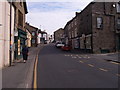

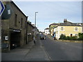
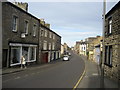
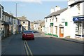
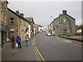
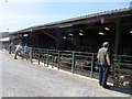
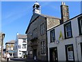
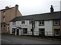
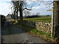
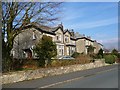
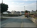
71 photos from this area
Area Information
Key information about the LA2 7LF including its size, population, and administrative classification.
- Area Type
- Postcode
- Area Size
- 2.1 hectares
- Population
- 1701
- Population Density
- 716 people/km²
House Prices in LA2 7LF
29
Properties
£203,100
Average Sold Price
£137,500
Lowest Price
£315,000
Highest Price
Showing 29 properties
| Address | Type | Beds | Baths | Last Sale Price | Last Sale Date | |
|---|---|---|---|---|---|---|
| Belmont, 24 Station Road, High Bentham, LA2 7LF | house | - | - | £250,000 | Apr 2022 | |
| Station View, 28 Station Road, High Bentham, LA2 7LF | house | - | - | £165,000 | Sep 2021 | |
| Chestnut House, 18 Station Road, High Bentham, LA2 7LF | Terraced | 5 | - | £315,000 | Jun 2021 | |
| Flat, 8 Station Road, High Bentham, LA2 7LF | Flat | - | - | £137,500 | Aug 2020 | |
| The Manse, 22 Station Road, High Bentham, LA2 7LF | house | - | - | £148,000 | Mar 2014 | |
| 2, Victoria Cottages, Station Road, High Bentham, LA2 7LF | Semi-detached | 5 | 2 | - | - | |
| Elsinore, 16 Station Road, High Bentham, LA2 7LF | Terraced | - | - | - | - | |
| Station View, Station Road, High Bentham, LA2 7LF | Semi-detached | - | - | - | - | |
| Flat, Guy Hairdresser, 8 Station Road, High Bentham, LA2 7LF | Flat | - | - | - | - | |
| Flat, Old Midland Bank, Station Road, High Bentham, LA2 7LF | Flat | - | - | - | - |
Page 1 of 3
Energy Efficiency in LA2 7LF
Amenities
Schools
| Rank | School | Type | Entry gender | Ages |
|---|
Explore more schools in this area
Go to Schools tabDemographics
Household Size
One person
most common
Accommodation Type
Houses
most common
Tenure
67
majority
Ethnic Group
White
most common
Religion
N/A
most common
Household Composition
N/A
most common
Age
47
median
Adults (30-64 years)
most common
Household Deprivation
N/A
with no deprivation
NS-SEC
27
in Lower managerial occupations
Explore more demographic insights in this area
Go to Demographics tabPlanning
Planning Constraints
- Flood RiskPremium
- Ramsar Wetland SitesPremium
- Area of Outstanding Natural BeautyPremium
- Protected Nature ReservePremium
- Protected WoodlandPremium