Area Overview for Killinghall
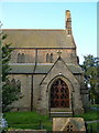
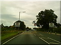
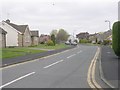
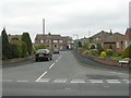
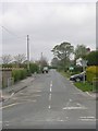
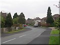
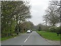
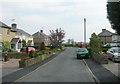
Photos of Killinghall


Area Information
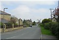
Living in Killinghall means residing within a built-up area that spans 62.9 hectares. This settlement sits in North Yorkshire, England, and functions as a established community with a distinct character. You will find a village atmosphere where residential streets interact with surrounding countryside. The area is defined by its scale and its position relative to nearby towns. Most residents enjoy a quiet lifestyle supported by local facilities and good transport links. Daily life revolves around convenience. Tesco Killinghall and Aldi Jennyfield are nearby, ensuring you can shop without travelling far. You have easy access to Harrogate Railway Station, Starbeck Railway Station, and Hornbeam Park Railway Station for wider travel. The community feels stable, with a high rate of people owning their homes rather than renting. This stability often suggests a neighbourhood where families and long-term residents settle down. You benefit from excellent digital connectivity, making remote work or streaming straightforward. The environment is generally safe, with crime rates below the national average.
- Area Type
- Built Up Area 250
- Area Size
- 62.9 hectares
- Population
- Not available
- Population Density
- Not available
Living in Killinghall offers practical access to local amenities within walking or short driving distance. You have five retail options nearby, ensuring daily needs are easily met. Tesco Killinghall, Aldi Jennyfield, and Co-op Jennyfield are among the notable shops you can visit. These supermarkets save you the time and fuel required to travel to larger towns for groceries. You can refill your pantry without leaving the immediate area. Transport links support your lifestyle with five nearby railway stations. Harrogate Railway Station, Starbeck Railway Station, and Hornbeam Park Railway Station provide convenient rail connections. You can reach Harrogate or other cities with minimal planning. This blend of local shopping and regional rail links creates a balanced lifestyle. You enjoy the convenience of local goods while retaining access to wider leisure options elsewhere. The area size of 62.9 hectares indicates a compact community where you do not need to travel far for basics. Retail categories like grocery stores and convenience outlets are sufficiently close to your doorstep. You can maintain a self-sufficient routine without excessive commuting to town centres. This balance of local independence and regional connectivity defines the day-to-day experience for residents.
Amenities
Schools
There is one primary school listed in the immediate vicinity of Killinghall. Killinghall Church of England Primary School serves the local catchment. This institution holds an Ofsted rating of good. The school designation indicates it is funded by the state but follows a Church of England ethos. You will find this is the sole primary option provided in the available data for the area. For families with children, this single school options means your residence location determines your children's education path. The good rating offers reassurance that the standard of education meets regulatory expectations. However, the absence of secondary school data in this specific dataset means you must research further for high school choices. You should verify attendance zones for any older children not covered by primary education. The mix of school types is currently limited to a single primary provider. This highlights the rural nature of Killinghall where fewer educational institutions exist close to the homes. If you have young children, the proximity to this one school is a practical benefit that saves travel time. You should check the school's specific religious provisions if your family has particular beliefs regarding education. The good rating suggests a solid foundation for early learning within the neighbourhood.
| Rank | A + A* % | School | Type | Entry gender | Ages |
|---|---|---|---|---|---|
| 1 | N/A | Killinghall Church of England Primary School | primary | N/A | N/A |
Explore more schools in this area
Go to Schools tabDemographics
The community in Killinghall has a distinct age profile. The median age is 70 years, which indicates that older residents form the largest segment of the population. This demographic detail shapes the local character and likely influences the types of services needed. You will find a neighbourhood where established households dominate the street scenes. Home ownership is the prevailing norm in this area. Exactly 70 percent of households own their homes outright or with a mortgage. This figure contrasts sharply with the levels found in major city centres or university towns where rentals are more common. The high ownership rate suggests a stable, long-term community where people invest in their properties locally. You do not need to worry about high tenant turnover rates affecting neighbourhood cohesion. Accommodation types and household compositions follow this trend of stability. You are not competing for scarce housing stock, as most units are in private hands. The age of 70 also implies that schools may primarily serve younger children amongst a larger population of grandparents or retired couples. This demographic makes sense when looking at the single primary school option available nearby, which caters to younger demographics rather than adolescents.
Household Size
Accommodation Type
Tenure
Ethnic Group
Religion
Household Composition
Age
Household Deprivation
NS-SEC
Explore more demographic insights in this area
Go to Demographics tabPlanning
Planning Constraints
- Crime RiskLocked