Area Overview for HX7 8TG
Photos of HX7 8TG
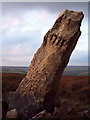
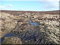
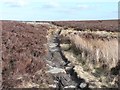
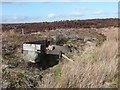
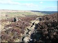
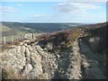
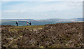
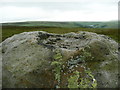
48 photos from this area
Area Information
Key information about the HX7 8TG including its size, population, and administrative classification.
- Area Type
- Postcode
- Area Size
- 1.5 km²
- Population
- 1568
- Population Density
- 273 people/km²
House Prices in HX7 8TG
9
Properties
£639,167
Average Sold Price
£345,000
Lowest Price
£900,000
Highest Price
Showing 9 properties
| Address | Type | Beds | Baths | Last Sale Price | Last Sale Date | |
|---|---|---|---|---|---|---|
| Souter House, Burlees Lane, Dodd Naze, Hebden Bridge, HX7 8TG | Semi-detached | - | - | £672,500 | Aug 2019 | |
| Keelam Farm, Dike Lane, Old Town, Hebden Bridge, HX7 8TG | house | - | - | £900,000 | May 2019 | |
| Claytons Farm, Dike Lane, Old Town, Hebden Bridge, HX7 8TG | Detached | - | - | £345,000 | Jan 2003 | |
| Old Hold Farm, Latham Lane, Old Town, Hebden Bridge, HX7 8TG | house | 4 | 2 | - | - | |
| Commons Farm, Latham Lane, Old Town, Hebden Bridge, HX7 8TG | Detached | 5 | - | - | - | |
| Former Dick Ing, Lane Ends Lane, Old Town, Hebden Bridge, HX7 8TG | Semi-detached | - | - | - | - | |
| Latham Farm, Latham Lane, Old Town, Hebden Bridge, HX7 8TG | house | - | - | - | - | |
| Little Rundell Farm, Dike Lane, Old Town, Hebden Bridge, HX7 8TG | Detached | - | - | - | - | |
| Keelham Chalet, Dike Lane, Old Town, Hebden Bridge, HX7 8TG | Detached | - | - | - | - |
Energy Efficiency in HX7 8TG
Amenities
Schools
| Rank | School | Type | Entry gender | Ages |
|---|
Explore more schools in this area
Go to Schools tabDemographics
Household Size
Two person
most common
Accommodation Type
Houses
most common
Tenure
75
majority
Ethnic Group
White
most common
Religion
N/A
most common
Household Composition
N/A
most common
Age
47
median
Adults (30-64 years)
most common
Household Deprivation
N/A
with no deprivation
NS-SEC
48
in Lower managerial occupations
Explore more demographic insights in this area
Go to Demographics tabPlanning
Planning Constraints
- Flood RiskPremium
- Ramsar Wetland SitesPremium
- Area of Outstanding Natural BeautyPremium
- Protected Nature ReservePremium
- Protected WoodlandPremium