Area Overview for HX7 7JF
Photos of HX7 7JF
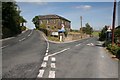
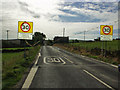
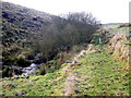
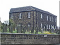
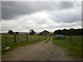
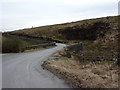
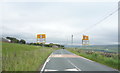
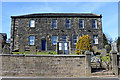
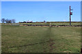
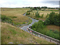
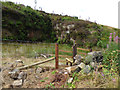
49 photos from this area
Area Information
Key information about the HX7 7JF including its size, population, and administrative classification.
- Area Type
- Postcode
- Area Size
- 36.9 hectares
- Population
- 1574
- Population Density
- 69 people/km²
House Prices in HX7 7JF
18
Properties
£339,786
Average Sold Price
£202,000
Lowest Price
£435,000
Highest Price
Showing 18 properties
| Address | Type | Beds | Baths | Last Sale Price | Last Sale Date | |
|---|---|---|---|---|---|---|
| Edge View, Badger Lane, Blackshaw Head, Hebden Bridge, HX7 7JF | Detached | 5 | 2 | £363,500 | Mar 2025 | |
| Moorcroft, Lower Back Lane, Hebden Bridge, HX7 7JF | Detached | 4 | 3 | £420,000 | Oct 2017 | |
| Blue Ball Cottage, The Long Causeway, Blackshaw Head, Hebden Bridge, HX7 7JF | Semi-detached | 2 | 1 | £202,000 | Mar 2016 | |
| Wellside, The Long Causeway, Blackshaw Head, Hebden Bridge, HX7 7JF | Detached | 4 | - | £435,000 | Jan 2016 | |
| Hamer Cottage, The Long Causeway, Blackshaw Head, Hebden Bridge, HX7 7JF | Detached | 3 | - | £315,000 | Sep 2014 | |
| Blue Ball House, The Long Causeway, Blackshaw Head, Hebden Bridge, HX7 7JF | house | 4 | - | £350,000 | May 2006 | |
| Davy Hall, The Long Causeway, Blackshaw Head, Hebden Bridge, HX7 7JF | house | - | - | £293,000 | Mar 2006 | |
| 3, Causeway Fold, The Long Causeway, Blackshaw Head, Hebden Bridge, HX7 7JF | Terraced | 3 | 1 | - | - | |
| 1, Causeway Fold, The Long Causeway, Blackshaw Head, Hebden Bridge, HX7 7JF | Semi-detached | 4 | 2 | - | - | |
| 2, Causeway Fold, The Long Causeway, Blackshaw Head, Hebden Bridge, HX7 7JF | Terraced | 3 | 1 | - | - |
Page 1 of 2
Energy Efficiency in HX7 7JF
Amenities
Schools
| Rank | School | Type | Entry gender | Ages |
|---|
Explore more schools in this area
Go to Schools tabDemographics
Household Size
Two person
most common
Accommodation Type
Houses
most common
Tenure
88
majority
Ethnic Group
White
most common
Religion
N/A
most common
Household Composition
N/A
most common
Age
47
median
Adults (30-64 years)
most common
Household Deprivation
N/A
with no deprivation
NS-SEC
49
in Lower managerial occupations
Explore more demographic insights in this area
Go to Demographics tabPlanning
Planning Constraints
- Flood RiskPremium
- Ramsar Wetland SitesPremium
- Area of Outstanding Natural BeautyPremium
- Protected Nature ReservePremium
- Protected WoodlandPremium