Area Overview for HX7 7AZ
Photos of HX7 7AZ
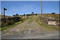
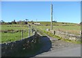
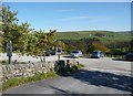
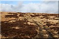
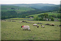
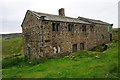
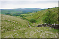
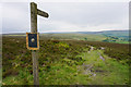
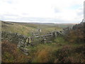
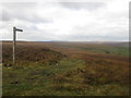
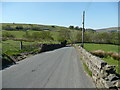
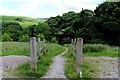
41 photos from this area
Area Information
Key information about the HX7 7AZ including its size, population, and administrative classification.
- Area Type
- Postcode
- Area Size
- 2.1 km²
- Population
- 1464
- Population Density
- 23 people/km²
House Prices in HX7 7AZ
34
Properties
£437,550
Average Sold Price
£50,000
Lowest Price
£755,000
Highest Price
Showing 34 properties
| Address | Type | Beds | Baths | Last Sale Price | Last Sale Date | |
|---|---|---|---|---|---|---|
| Cloverfields Barn, Widdop Road, Heptonstall, Hebden Bridge, HX7 7AZ | house | - | - | £605,000 | Sep 2021 | |
| Acre House, Widdop Road, Heptonstall, Hebden Bridge, HX7 7AZ | house | 2 | 1 | £380,000 | Jul 2021 | |
| Pheasant Field Barn, Widdop Road, Heptonstall, Hebden Bridge, HX7 7AZ | house | - | - | £565,000 | Mar 2020 | |
| Bent Head, Widdop Road, Heptonstall, Hebden Bridge, HX7 7AZ | Farm | 3 | 1 | £440,000 | Dec 2017 | |
| New Greenwood Lee Farm, Widdop Road, Heptonstall, Hebden Bridge, HX7 7AZ | Detached | 4 | 2 | £425,000 | Oct 2017 | |
| High Greenwood Farm, Widdop Road, Heptonstall, Hebden Bridge, HX7 7AZ | Detached | 4 | - | £590,000 | Oct 2017 | |
| New Bent Head Farm, Widdop Road, Heptonstall, Hebden Bridge, HX7 7AZ | house | - | - | £450,000 | Sep 2009 | |
| Boothroyd Farm, Widdop Road, Heptonstall, Hebden Bridge, HX7 7AZ | Detached | - | - | £755,000 | May 2007 | |
| Acre Piggery, Widdop Road, Heptonstall, Hebden Bridge, HX7 7AZ | house | - | - | £50,000 | Nov 2002 | |
| Acre Lane Cottage, Acre Lane, Heptonstall, Hebden Bridge, HX7 7AZ | Detached | - | - | £115,500 | Jul 1995 |
Page 1 of 4
Energy Efficiency in HX7 7AZ
Amenities
Schools
| Rank | School | Type | Entry gender | Ages |
|---|
Explore more schools in this area
Go to Schools tabDemographics
Household Size
Two person
most common
Accommodation Type
Houses
most common
Tenure
82
majority
Ethnic Group
White
most common
Religion
N/A
most common
Household Composition
N/A
most common
Age
47
median
Adults (30-64 years)
most common
Household Deprivation
N/A
with no deprivation
NS-SEC
48
in Lower managerial occupations
Explore more demographic insights in this area
Go to Demographics tabPlanning
Planning Constraints
- Flood RiskPremium
- Ramsar Wetland SitesPremium
- Area of Outstanding Natural BeautyPremium
- Protected Nature ReservePremium
- Protected WoodlandPremium