Area Overview for HX6 4RF
Photos of HX6 4RF
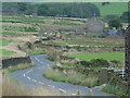
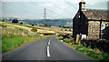
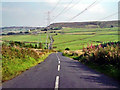
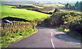
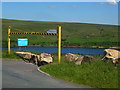
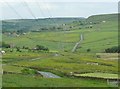
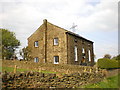
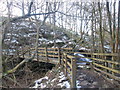
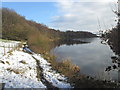
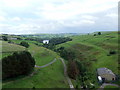
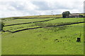
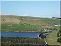
55 photos from this area
Area Information
Key information about the HX6 4RF including its size, population, and administrative classification.
- Area Type
- Postcode
- Area Size
- 1.9 km²
- Population
- 1404
- Population Density
- 34 people/km²
House Prices in HX6 4RF
18
Properties
£552,500
Average Sold Price
£350,000
Lowest Price
£750,000
Highest Price
Showing 18 properties
| Address | Type | Beds | Baths | Last Sale Price | Last Sale Date | |
|---|---|---|---|---|---|---|
| Hutch Royd Farm, Long Causeway, Rishworth, Sowerby Bridge, HX6 4RF | Detached | 4 | 2 | £540,000 | May 2019 | |
| Parrock Nook Farm, Long Causeway, Rishworth, Sowerby Bridge, HX6 4RF | house | - | - | £570,000 | Jan 2018 | |
| Lower Wormald Cottage, 3 Lower Wormald, Rishworth, Sowerby Bridge, HX6 4RF | Detached | 4 | 2 | £350,000 | Jun 2014 | |
| Higher Wormald, Back O Th Height, Rishworth, Sowerby Bridge, HX6 4RF | house | - | - | £750,000 | Nov 2009 | |
| Hutch Green Farm, Long Causeway, Rishworth, Sowerby Bridge, HX6 4RF | Detached | 4 | 2 | - | - | |
| Former Caravan, Rishworth Congregational Church, Long Causeway, Rishworth, Sowerby Bridge, HX6 4RF | Mobile Home | - | - | - | - | |
| New Barn Farm, Lower Wormald, Rishworth, Sowerby Bridge, HX6 4RF | Detached | - | - | - | - | |
| Blackwood Farm, Long Causeway, Rishworth, Sowerby Bridge, HX6 4RF | Detached | - | - | - | - | |
| 5 Lower Wormald, Rishworth, Sowerby Bridge, HX6 4RF | Detached | - | - | - | - | |
| 1 Lower Wormald, Rishworth, Sowerby Bridge, HX6 4RF | Semi-detached | - | - | - | - |
Page 1 of 2
Energy Efficiency in HX6 4RF
Amenities
Schools
| Rank | School | Type | Entry gender | Ages |
|---|
Explore more schools in this area
Go to Schools tabDemographics
Household Size
Two person
most common
Accommodation Type
Houses
most common
Tenure
82
majority
Ethnic Group
White
most common
Religion
N/A
most common
Household Composition
N/A
most common
Age
47
median
Adults (30-64 years)
most common
Household Deprivation
N/A
with no deprivation
NS-SEC
44
in Lower managerial occupations
Explore more demographic insights in this area
Go to Demographics tabPlanning
Planning Constraints
- Flood RiskPremium
- Ramsar Wetland SitesPremium
- Area of Outstanding Natural BeautyPremium
- Protected Nature ReservePremium
- Protected WoodlandPremium