Area Overview for HX6 4HS
Photos of HX6 4HS
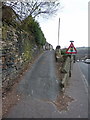
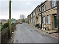
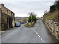
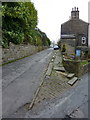
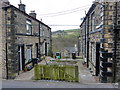
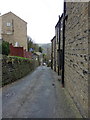
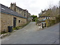


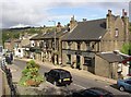
100 photos from this area
Area Information
Key information about the HX6 4HS including its size, population, and administrative classification.
- Area Type
- Postcode
- Area Size
- 6.8 hectares
- Population
- 2491
- Population Density
- 663 people/km²
House Prices in HX6 4HS
19
Properties
£278,438
Average Sold Price
£210,000
Lowest Price
£475,000
Highest Price
Showing 19 properties
| Address | Type | Beds | Baths | Last Sale Price | Last Sale Date | |
|---|---|---|---|---|---|---|
| 3, Vale Court, Mill Fold Way, Ripponden, Sowerby Bridge, HX6 4HS | Detached | 4 | 3 | £475,000 | Sep 2025 | |
| Ellis Bottom Cottage, Mill Fold Way, Ripponden, Sowerby Bridge, HX6 4HS | house | - | - | £240,000 | Apr 2022 | |
| 11, Vale Court, Mill Fold Way, Ripponden, Sowerby Bridge, HX6 4HS | Flat | - | - | £210,000 | Dec 2019 | |
| 8, Vale Court, Mill Fold Way, Ripponden, Sowerby Bridge, HX6 4HS | house | - | - | £285,000 | Sep 2018 | |
| 14, Vale Court, Mill Fold Way, Ripponden, Sowerby Bridge, HX6 4HS | house | - | - | £250,000 | Sep 2018 | |
| 16, Vale Court, Mill Fold Way, Ripponden, Sowerby Bridge, HX6 4HS | Semi-detached | 3 | 2 | £255,000 | Sep 2018 | |
| 10, Vale Court, Mill Fold Way, Ripponden, Sowerby Bridge, HX6 4HS | Detached | 3 | 2 | £250,000 | Sep 2018 | |
| 9, Vale Court, Mill Fold Way, Ripponden, Sowerby Bridge, HX6 4HS | house | - | - | £250,000 | Aug 2018 | |
| 17, Vale Court, Mill Fold Way, Ripponden, Sowerby Bridge, HX6 4HS | house | 3 | 2 | £255,000 | Aug 2018 | |
| 15, Vale Court, Mill Fold Way, Ripponden, Sowerby Bridge, HX6 4HS | house | - | - | £255,000 | Aug 2018 |
Page 1 of 2
Energy Efficiency in HX6 4HS
Amenities
Schools
| Rank | School | Type | Entry gender | Ages |
|---|
Explore more schools in this area
Go to Schools tabDemographics
Household Size
Family (3-5 people)
most common
Accommodation Type
Houses
most common
Tenure
82
majority
Ethnic Group
White
most common
Religion
N/A
most common
Household Composition
N/A
most common
Age
47
median
Adults (30-64 years)
most common
Household Deprivation
N/A
with no deprivation
NS-SEC
51
in Lower managerial occupations
Explore more demographic insights in this area
Go to Demographics tabPlanning
Planning Constraints
- Flood RiskPremium
- Ramsar Wetland SitesPremium
- Area of Outstanding Natural BeautyPremium
- Protected Nature ReservePremium
- Protected WoodlandPremium