Area Overview for HX6 4DG
Photos of HX6 4DG
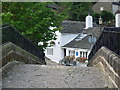
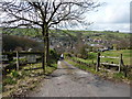
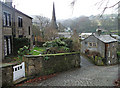
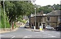
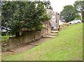
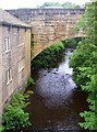
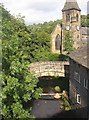
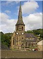
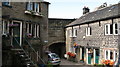


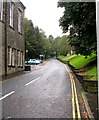
100 photos from this area
Area Information
Key information about the HX6 4DG including its size, population, and administrative classification.
- Area Type
- Postcode
- Area Size
- 4.2 hectares
- Population
- 1635
- Population Density
- 462 people/km²
House Prices in HX6 4DG
22
Properties
£305,045
Average Sold Price
£125,000
Lowest Price
£500,000
Highest Price
Showing 22 properties
| Address | Type | Beds | Baths | Last Sale Price | Last Sale Date | |
|---|---|---|---|---|---|---|
| Croft Cottage, 10 Old Bank, Ripponden, Sowerby Bridge, HX6 4DG | Semi-detached | 3 | 1 | £405,000 | Jan 2025 | |
| 14 Old Bank, Ripponden, Sowerby Bridge, HX6 4DG | house | 2 | 1 | £320,000 | Sep 2024 | |
| 15 Old Bank, Ripponden, Sowerby Bridge, HX6 4DG | Detached | 4 | 3 | £500,000 | Feb 2023 | |
| 1, Chapelfield Croft, Old Bank, Ripponden, Sowerby Bridge, HX6 4DG | house | - | - | £190,000 | Jun 2021 | |
| Chapel Field Barn, Old Bank, Ripponden, Sowerby Bridge, HX6 4DG | Semi-detached | 3 | 2 | £280,000 | Oct 2019 | |
| White Acre, Ripponden Old Bank, Ripponden, Sowerby Bridge, HX6 4DG | house | - | - | £437,500 | Jan 2018 | |
| 4 Old Bank, Ripponden, Sowerby Bridge, HX6 4DG | Semi-detached | 3 | 1 | £272,000 | Apr 2017 | |
| 9 Old Bank, Ripponden, Sowerby Bridge, HX6 4DG | house | - | - | £125,000 | Jun 2014 | |
| Hunters Hill, Ripponden Old Bank, Ripponden, Sowerby Bridge, HX6 4DG | Detached | - | - | £380,000 | Apr 2007 | |
| Rockery Cottage, 18 Old Bank, Ripponden, Sowerby Bridge, HX6 4DG | Detached | - | - | £260,000 | Aug 2006 |
Page 1 of 3
Energy Efficiency in HX6 4DG
Amenities
Schools
| Rank | School | Type | Entry gender | Ages |
|---|
Explore more schools in this area
Go to Schools tabDemographics
Household Size
Two person
most common
Accommodation Type
Houses
most common
Tenure
71
majority
Ethnic Group
White
most common
Religion
N/A
most common
Household Composition
N/A
most common
Age
47
median
Adults (30-64 years)
most common
Household Deprivation
N/A
with no deprivation
NS-SEC
43
in Lower managerial occupations
Explore more demographic insights in this area
Go to Demographics tabPlanning
Planning Constraints
- Flood RiskPremium
- Ramsar Wetland SitesPremium
- Area of Outstanding Natural BeautyPremium
- Protected Nature ReservePremium
- Protected WoodlandPremium