Area Overview for HX6 2EL
Photos of HX6 2EL

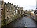

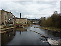
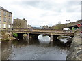
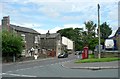
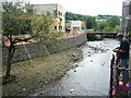
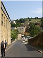
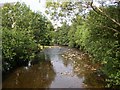
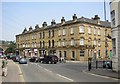
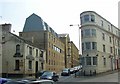
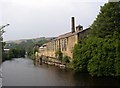
100 photos from this area
Area Information
Key information about the HX6 2EL including its size, population, and administrative classification.
- Area Type
- Postcode
- Area Size
- 5348 m²
- Population
- 1495
- Population Density
- 8442 people/km²
House Prices in HX6 2EL
13
Properties
£107,536
Average Sold Price
£17,250
Lowest Price
£260,000
Highest Price
Showing 13 properties
| Address | Type | Beds | Baths | Last Sale Price | Last Sale Date | |
|---|---|---|---|---|---|---|
| 57A Tuel Lane, Sowerby Bridge, HX6 2EL | Terraced | 2 | 1 | £160,000 | Nov 2022 | |
| 57 Tuel Lane, Sowerby Bridge, HX6 2EL | Terraced | 2 | 1 | £160,000 | Nov 2022 | |
| 49 Tuel Lane, Sowerby Bridge, HX6 2EL | Terraced | 2 | 1 | £67,500 | Feb 2019 | |
| Fairhaven, 27 Tuel Lane, Sowerby Bridge, HX6 2EL | Detached | 5 | 1 | £260,000 | Jan 2018 | |
| 45 Tuel Lane, Sowerby Bridge, HX6 2EL | Terraced | 2 | - | £63,000 | Sep 2016 | |
| 47 Tuel Lane, Sowerby Bridge, HX6 2EL | house | - | - | £25,000 | Mar 2001 | |
| 51 Tuel Lane, Sowerby Bridge, HX6 2EL | house | - | - | £17,250 | Apr 1998 | |
| Former 55, Tuel Lane, Sowerby Bridge, HX6 2EL | Terraced | - | - | - | - | |
| 61A Tuel Lane, Sowerby Bridge, HX6 2EL | Industrial | - | - | - | - | |
| 59A Tuel Lane, Sowerby Bridge, HX6 2EL | Flat | - | - | - | - |
Page 1 of 2
Energy Efficiency in HX6 2EL
Amenities
Schools
| Rank | School | Type | Entry gender | Ages |
|---|
Explore more schools in this area
Go to Schools tabDemographics
Household Size
One person
most common
Accommodation Type
Houses
most common
Tenure
57
majority
Ethnic Group
White
most common
Religion
N/A
most common
Household Composition
N/A
most common
Age
47
median
Adults (30-64 years)
most common
Household Deprivation
N/A
with no deprivation
NS-SEC
29
in Lower managerial occupations
Explore more demographic insights in this area
Go to Demographics tabPlanning
Planning Constraints
- Flood RiskPremium
- Ramsar Wetland SitesPremium
- Area of Outstanding Natural BeautyPremium
- Protected Nature ReservePremium
- Protected WoodlandPremium