Area Overview for HX5 9YW
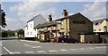
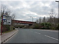
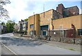
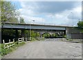
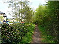
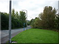
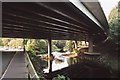
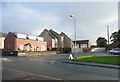
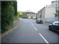
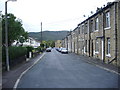
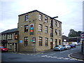
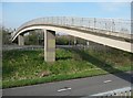
Photos of HX5 9YW
Area Information
HX5 9YW is a compact residential postcode in England, home to 1,773 people spread across a small cluster of homes. With a population density of 888 people per square kilometre, it is a tightly knit community where daily life is shaped by proximity to essential services and transport links. The area’s character is defined by its mature demographic, with a median age of 47 and a majority of residents aged between 30 and 64. This suggests a stable, established population, likely with long-term ties to the local area. The presence of five nearby rail stations—including Brighouse, Halifax, and Huddersfield—offers strong connectivity to surrounding towns and cities, while five retail outlets such as Morrisons Lower and Co-op Field provide convenience for everyday needs. Living here means balancing a quiet, residential environment with access to broader opportunities, making it suitable for those seeking a blend of community and practicality.
- Area Type
- Postcode
- Area Size
- Not available
- Population
- 1773
- Population Density
- 888 people/km²
The property market in HX5 9YW is characterised by a 50% home ownership rate, suggesting a balance between owner-occupied and rental properties. The area is predominantly composed of houses, which may indicate a focus on family-friendly housing stock. Given the small size of the postcode and its immediate surroundings, the housing stock is likely limited, which could make the market competitive for buyers. The presence of houses rather than flats or apartments may appeal to those seeking more space or long-term stability. However, the lack of specific data on property prices or availability means that buyers should consider the broader regional market when assessing potential investment or relocation opportunities. The area’s proximity to rail networks may also influence its desirability for commuters.
House Prices in HX5 9YW
No properties found in this postcode.
Energy Efficiency in HX5 9YW
The lifestyle in HX5 9YW is shaped by its proximity to essential retail and transport hubs. Five nearby retail outlets, including Morrisons Lower, Aldi Lower, and Co-op Field, provide easy access to groceries, household goods, and everyday conveniences. These shops contribute to a practical, community-oriented environment where residents can meet daily needs without long journeys. The area’s rail network, with stations such as Brighouse and Huddersfield, offers swift connections to surrounding towns, facilitating both commuting and leisure travel. While the data does not mention parks or leisure facilities, the presence of multiple retail and transport options suggests a focus on functionality and accessibility. This makes HX5 9YW appealing to those prioritising convenience and connectivity in their daily routines.
Amenities
Schools
| Rank | School | Type | Entry gender | Ages |
|---|
Explore more schools in this area
Go to Schools tabDemographics
The population of HX5 9YW is predominantly composed of adults aged 30 to 64, reflecting a mature community with a median age of 47. This age range suggests a stable demographic, likely with established careers and family structures. Home ownership in the area stands at 50%, indicating a balanced mix of owner-occupied and rental properties. The accommodation type is primarily houses, which aligns with the area’s residential character and may appeal to families or those preferring larger living spaces. The predominant ethnic group is White, though the data does not provide further details on diversity or deprivation levels. The absence of specific information on socioeconomic deprivation means that quality of life factors such as access to services and safety must be inferred from other metrics, such as the moderate crime risk and robust digital connectivity.
Household Size
Accommodation Type
Tenure
Ethnic Group
Religion
Household Composition
Age
Household Deprivation
NS-SEC
Explore more demographic insights in this area
Go to Demographics tabPlanning
Planning Constraints
- Flood RiskPremium
- Ramsar Wetland SitesPremium
- Area of Outstanding Natural BeautyPremium
- Protected Nature ReservePremium
- Protected WoodlandPremium