Area Overview for HX5 0WX
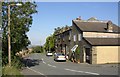
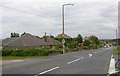
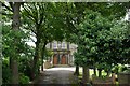
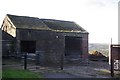
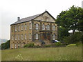
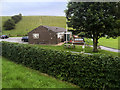
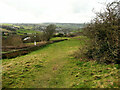
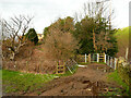
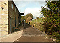
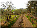
Photos of HX5 0WX


Area Information
HX5 0WX is a small, tightly packed residential area in England, home to 1,865 people spread across a compact footprint. With a population density of 1,252 people per square kilometre, it reflects a community that is both closely knit and conveniently located. The area’s character is shaped by its proximity to essential services, including retail outlets and rail stations, which make daily life practical for residents. While it is not a sprawling suburb, its size means that amenities are within walking or short driving distance. The demographic profile suggests a mature population, with a median age of 47 and a strong presence of adults aged 30–64. This hints at a stable, established community where many residents are likely long-term homeowners. The area’s small scale means it is not a destination for large families or young professionals seeking expansion, but rather a place where familiarity and convenience are prioritised. For those considering a move, HX5 0WX offers a quiet, manageable lifestyle with access to nearby towns and transport links.
- Area Type
- Postcode
- Area Size
- Not available
- Population
- 1865
- Population Density
- 1252 people/km²
The property market in HX5 0WX is characterised by a high rate of home ownership—84% of residents own their homes. This suggests a community where long-term residency is the norm, with limited rental activity. The predominant accommodation type is houses, which is typical of areas with lower population density and a focus on single-family dwellings. Given the area’s small size, the housing stock is likely limited, meaning buyers may face competition for available properties. The high proportion of owner-occupied homes indicates a stable market, with fewer fluctuations in property values compared to areas with a higher rental presence. For prospective buyers, this means opportunities are likely to be constrained to existing homes rather than new developments. The compact nature of HX5 0WX also means that properties are closely spaced, so buyers should consider the area’s limitations in terms of expansion or renovation. The market is not geared toward investors seeking rental yields, but rather toward those seeking a settled, low-maintenance home.
House Prices in HX5 0WX
No properties found in this postcode.
Energy Efficiency in HX5 0WX
The lifestyle in HX5 0WX is supported by a selection of nearby amenities, including five retail outlets such as Aldi Lower, Tesco Huddersfield, and Co-op Birchencliffe. These shops offer essential goods, making daily errands convenient without the need for long trips. The rail stations provide access to broader networks, enabling residents to explore nearby towns or cities for additional shopping, dining, or leisure opportunities. While the data does not list parks or recreational facilities, the proximity to rail links suggests that outdoor activities may be available in nearby areas. The presence of multiple retail options and transport hubs indicates a practical, community-focused lifestyle where residents can meet daily needs without significant travel. The area’s compact nature means that amenities are closely clustered, reinforcing a sense of accessibility and convenience for those prioritising ease of movement.
Amenities
Schools
The nearest school to HX5 0WX is Cross Lane Primary and Nursery School, which is rated ‘good’ by Ofsted. This primary school serves the area’s younger residents, providing education for children aged 3–11. The absence of secondary schools in the immediate vicinity means families with older children may need to look further afield for secondary education, but the primary school’s quality rating offers reassurance for those prioritising early education. The school’s presence contributes to the area’s appeal for families, though the lack of a broader range of educational institutions could be a consideration for those planning for long-term schooling needs. The data does not include information on other schools, so it is unclear whether additional options exist within a reasonable commute. For now, Cross Lane Primary and Nursery School stands as the sole named educational institution in the area.
| Rank | School | Type | Entry gender | Ages |
|---|
Explore more schools in this area
Go to Schools tabDemographics
The community in HX5 0WX is predominantly composed of adults aged 30–64, with a median age of 47. This suggests a population that is largely in their prime working years or nearing retirement, contributing to a stable, mature demographic. Home ownership is high, with 84% of residents owning their homes, indicating a long-term commitment to the area. The accommodation type is primarily houses, which aligns with the higher proportion of owner-occupied properties compared to flats or rental units. The predominant ethnic group is White, reflecting a homogenous population with no significant data on other ethnicities provided. The absence of detailed diversity metrics means the area’s cultural composition remains largely unexplored in the data, but the figures suggest a community with few recent demographic shifts. The high home ownership rate and age profile imply a low turnover of residents, fostering a sense of continuity. However, the lack of specific data on deprivation or income levels means the area’s economic resilience cannot be fully assessed.
Household Size
Accommodation Type
Tenure
Ethnic Group
Religion
Household Composition
Age
Household Deprivation
NS-SEC
Explore more demographic insights in this area
Go to Demographics tabPlanning
Planning Constraints
- Flood RiskPremium
- Ramsar Wetland SitesPremium
- Area of Outstanding Natural BeautyPremium
- Protected Nature ReservePremium
- Protected WoodlandPremium