Area Overview for HX5 0WW
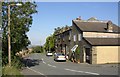
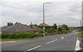
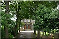
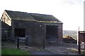
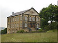
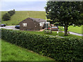
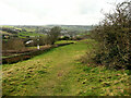
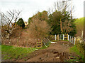
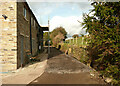
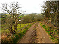
Photos of HX5 0WW


Area Information
HX5 0WW is a small, tightly knit residential postcode in England, home to 1,865 people spread across a compact area with a population density of 1,252 people per square kilometre. This is a community of established residents, with a median age of 47 and a majority of adults aged 30–64. The area is characterised by a high rate of home ownership—84% of properties are owner-occupied—suggesting long-term residency and stability. Most homes are houses, reflecting a suburban or semi-rural setting. Daily life here balances local convenience with proximity to nearby towns. The postcode’s compact size means amenities are within practical reach, and the surrounding area includes rail stations, retail outlets, and schools. While the population is relatively small, the density suggests a mix of family homes and older properties. HX5 0WW is not a high-risk area for flooding or environmental constraints, though crime rates are average, requiring standard precautions. For those seeking a quiet, settled community with access to essential services, this area offers a blend of practicality and familiarity.
- Area Type
- Postcode
- Area Size
- Not available
- Population
- 1865
- Population Density
- 1252 people/km²
The property market in HX5 0WW is dominated by owner-occupied homes, with 84% of properties owned by residents rather than rented. This suggests a community of long-term residents rather than a transient rental market. The predominant accommodation type is houses, which is unusual for a small postcode area but may indicate a mix of semi-detached or detached properties. Given the high home ownership rate and the presence of family-oriented demographics, the area is likely to have a limited number of properties available for purchase, particularly within the immediate vicinity. Buyers should consider that the housing stock is finite, and competition may be higher for properties that meet the needs of families or older households. The focus on houses rather than flats or apartments also means that the market may appeal more to those seeking space and privacy over high-density living.
House Prices in HX5 0WW
No properties found in this postcode.
Energy Efficiency in HX5 0WW
The lifestyle in HX5 0WW is shaped by its proximity to retail and transport hubs. Within reach are five notable retail outlets, including Aldi Lower, Tesco Huddersfield, and Co-op Birchencliffe, providing essential shopping options for daily needs. While the data does not mention specific parks or leisure facilities, the rail stations offer access to larger towns with more extensive amenities. The area’s small size means that residents can walk or cycle to nearby shops and stations, fostering a convenient, low-traffic environment. The presence of multiple rail links enhances connectivity, making it easier to access cultural, recreational, and professional opportunities beyond the immediate postcode. However, the lack of detailed information on green spaces or leisure venues suggests that outdoor activities may require travel to nearby areas. The retail options and transport links, however, ensure that daily life remains practical and accessible.
Amenities
Schools
The nearest school to HX5 0WW is Cross Lane Primary and Nursery School, which provides education for young children and holds an Ofsted rating of ‘good’. This is the only school explicitly listed in the data, meaning families with children under 11 may find this the primary local option. However, no secondary schools are mentioned, suggesting that parents may need to look beyond the immediate area for secondary education. The presence of a primary school with a good rating is a positive factor for families prioritising early education, but the absence of higher-level schooling could be a consideration for those planning for long-term educational needs. The school’s rating indicates a satisfactory standard of teaching and facilities, though specific details about its size, catchment area, or performance metrics are not provided.
| Rank | School | Type | Entry gender | Ages |
|---|
Explore more schools in this area
Go to Schools tabDemographics
The community in HX5 0WW is predominantly middle-aged, with a median age of 47 and the largest age group being adults aged 30–64. This suggests a population largely in their prime working years, with families and older households. Home ownership is high at 84%, indicating a stable, long-term resident base rather than a transient rental market. The accommodation type is primarily houses, which aligns with the demographic profile of established families. The predominant ethnic group is White, reflecting a homogenous population. While no specific data on deprivation is provided, the high home ownership rate and age distribution imply a community with relatively stable economic conditions. However, the average age and lack of younger residents may mean limited demand for schools catering to children under 10. This demographic profile shapes a quiet, low-traffic environment where local amenities and services are tailored to the needs of older and middle-aged residents.
Household Size
Accommodation Type
Tenure
Ethnic Group
Religion
Household Composition
Age
Household Deprivation
NS-SEC
Explore more demographic insights in this area
Go to Demographics tabPlanning
Planning Constraints
- Flood RiskPremium
- Ramsar Wetland SitesPremium
- Area of Outstanding Natural BeautyPremium
- Protected Nature ReservePremium
- Protected WoodlandPremium