Area Overview for HX5 0SW
Photos of HX5 0SW
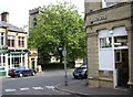
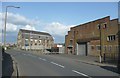
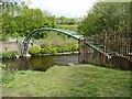
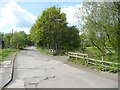
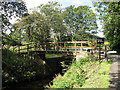
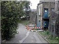
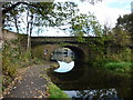
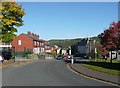
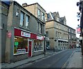
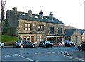

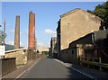
100 photos from this area
Area Information
Key information about the HX5 0SW including its size, population, and administrative classification.
- Area Type
- Postcode
- Area Size
- 31.3 hectares
- Population
- 1706
- Population Density
- 1495 people/km²
House Prices in HX5 0SW
58
Properties
£169,844
Average Sold Price
£48,500
Lowest Price
£360,000
Highest Price
Showing 58 properties
| Address | Type | Beds | Baths | Last Sale Price | Last Sale Date | |
|---|---|---|---|---|---|---|
| 2 Exley Lane, Elland, HX5 0SW | Terraced | 2 | 1 | £185,000 | Mar 2025 | |
| 56 Exley Lane, Elland, HX5 0SW | Semi-detached | 4 | 2 | £360,000 | Feb 2025 | |
| 20 Exley Lane, Elland, HX5 0SW | house | - | - | £162,000 | May 2024 | |
| 33 Exley Lane, Elland, HX5 0SW | house | - | - | £347,500 | May 2024 | |
| 34 Exley Lane, Elland, HX5 0SW | house | - | - | £247,000 | Nov 2023 | |
| 57 Exley Lane, Elland, HX5 0SW | Semi-detached | 3 | 2 | £331,000 | Oct 2023 | |
| 40 Exley Lane, Elland, HX5 0SW | house | - | - | £165,000 | Oct 2022 | |
| 15 Exley Lane, Elland, HX5 0SW | house | - | - | £270,000 | Oct 2022 | |
| 42 Exley Lane, Elland, HX5 0SW | Semi-detached | 2 | 1 | £190,000 | Apr 2022 | |
| 55 Exley Lane, Elland, HX5 0SW | Detached | 3 | 3 | £230,000 | Aug 2021 |
Page 1 of 6
Energy Efficiency in HX5 0SW
Amenities
Schools
| Rank | School | Type | Entry gender | Ages |
|---|
Explore more schools in this area
Go to Schools tabDemographics
Household Size
One person
most common
Accommodation Type
Flats
most common
Tenure
33
majority
Ethnic Group
White
most common
Religion
N/A
most common
Household Composition
N/A
most common
Age
47
median
Adults (30-64 years)
most common
Household Deprivation
N/A
with no deprivation
NS-SEC
23
in Lower managerial occupations
Explore more demographic insights in this area
Go to Demographics tabPlanning
Planning Constraints
- Flood RiskPremium
- Ramsar Wetland SitesPremium
- Area of Outstanding Natural BeautyPremium
- Protected Nature ReservePremium
- Protected WoodlandPremium