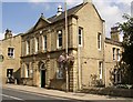
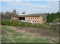
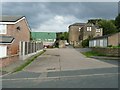
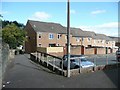
Area Overview for HX5 0ET
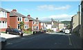
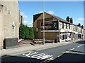
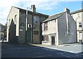
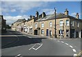
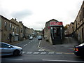
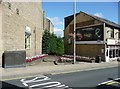
Photos of HX5 0ET


Area Information
HX5 0ET is a compact residential postcode in England, covering 413 square metres and home to 1,821 residents. Its high population density of 4.4 million people per square kilometre reflects a tightly knit community, though the area’s small size means it is more of a cluster than a sprawling suburb. The postcode sits near key transport hubs, with Brighouse, Halifax, and Huddersfield railway stations within reach, offering connections to major cities. Daily life here is shaped by proximity to retail, with Aldi Lower, Morrisons Lower, and Co-op Greetland within practical walking distance. The area’s demographics suggest a mature population, with a median age of 47 and most residents aged 30–64. While broadband connectivity is excellent, with a score of 99, the crime risk is critical, rated 30 out of 100. This duality of high digital connectivity and elevated safety concerns defines the lived experience in HX5 0ET, where convenience meets the need for vigilance.
- Area Type
- Postcode
- Area Size
- 413 m²
- Population
- 1821
- Population Density
- 2237 people/km²
The property market in HX5 0ET is characterised by a 50% home ownership rate, with houses forming the predominant accommodation type. This suggests a mix of owner-occupied and rental properties, though the data does not specify the proportion of each. The small area size and high population density indicate a compact housing stock, likely centred on family homes. For buyers, this means a limited number of properties available, with competition potentially fierce. The presence of nearby railway stations may attract commuters, but the area’s size means the immediate surroundings are the primary source of housing options. The lack of detailed data on property types or prices means buyers must focus on the known factors: a residential cluster with houses, moderate home ownership, and proximity to transport. This profile suits those prioritising proximity to services and connectivity over expansive living spaces.
House Prices in HX5 0ET
Showing 1 properties
| Address | Type | Beds | Baths | Last Sale Price | Last Sale Date | |
|---|---|---|---|---|---|---|
| Ramsdens Solicitors Llp, 94 Southgate, Elland, HX5 0ET | retail_financial | - | - | - | - |
Energy Efficiency in HX5 0ET
Life in HX5 0ET is shaped by its proximity to retail and transport hubs. Residents have access to Aldi Lower, Morrisons Lower, and Co-op Greetland, providing essential shopping options within walking distance. These stores cater to daily needs, from groceries to household items, reducing the necessity for long trips. The area’s railway stations—Brighouse, Halifax, and Huddersfield—offer connections to larger urban centres, facilitating both work and leisure travel. While the data does not mention parks or leisure facilities, the compact nature of the postcode suggests a focus on functional living over expansive recreational spaces. The combination of retail accessibility and transport links creates a convenient lifestyle, though the high population density may limit private outdoor areas. For those prioritising practicality over sprawling amenities, HX5 0ET offers a streamlined, service-rich environment.
Amenities
Schools
| Rank | School | Type | Entry gender | Ages |
|---|
Explore more schools in this area
Go to Schools tabDemographics
The community in HX5 0ET is predominantly composed of adults aged 30–64, with a median age of 47. This suggests a population skewed toward middle-aged individuals, likely including families and professionals. Home ownership sits at 50%, indicating a balance between owner-occupied and rental properties. The accommodation type is primarily houses, which may reflect a preference for family homes in this compact area. The predominant ethnic group is White, though no data on diversity or deprivation is provided. The high population density of 4.4 million people per square kilometre implies a closely packed residential environment, which could influence community dynamics and local services. For buyers, this profile suggests a stable, mature demographic but also potential challenges in terms of space and resource availability within the area’s limited footprint.
Household Size
Accommodation Type
Tenure
Ethnic Group
Religion
Household Composition
Age
Household Deprivation
NS-SEC
Explore more demographic insights in this area
Go to Demographics tabPlanning
Planning Constraints
- Flood RiskPremium
- Ramsar Wetland SitesPremium
- Area of Outstanding Natural BeautyPremium
- Protected Nature ReservePremium
- Protected WoodlandPremium