Area Overview for HX4 8JJ
Photos of HX4 8JJ

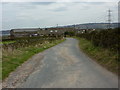
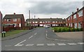
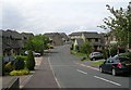


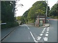


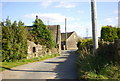
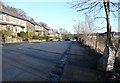
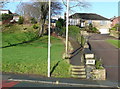
100 photos from this area
Area Information
Key information about the HX4 8JJ including its size, population, and administrative classification.
- Area Type
- Postcode
- Area Size
- 1.0 hectares
- Population
- 1656
- Population Density
- 280 people/km²
House Prices in HX4 8JJ
23
Properties
£246,775
Average Sold Price
£38,950
Lowest Price
£450,000
Highest Price
Showing 23 properties
| Address | Type | Beds | Baths | Last Sale Price | Last Sale Date | |
|---|---|---|---|---|---|---|
| 10-12 Martin Green Lane, Greetland, Elland, HX4 8JJ | Detached | 4 | 2 | £395,000 | Nov 2025 | |
| 2 Martin Green Lane, Greetland, Elland, HX4 8JJ | house | 3 | 2 | £300,000 | Aug 2023 | |
| 6 Martin Green Lane, Greetland, Elland, HX4 8JJ | Terraced | 2 | 1 | £135,000 | Aug 2023 | |
| Martin House, 11 Martin Green Lane, Greetland, Elland, HX4 8JJ | Semi-detached | 4 | - | £450,000 | Jun 2021 | |
| 50 Martin Green Lane, Greetland, Elland, HX4 8JJ | Semi-detached | 3 | 2 | £285,000 | Oct 2020 | |
| The Toll House, Martin Green Lane, Greetland, Elland, HX4 8JJ | Bungalow | - | - | £225,000 | Aug 2019 | |
| 30 Martin Green Lane, Greetland, Elland, HX4 8JJ | house | - | - | £302,000 | Apr 2018 | |
| 17 Martin Green Lane, Greetland, Elland, HX4 8JJ | Semi-detached | 3 | 2 | £265,000 | May 2017 | |
| 34 Martin Green Lane, Greetland, Elland, HX4 8JJ | house | - | - | £275,000 | Sep 2014 | |
| 32 Martin Green Lane, Greetland, Elland, HX4 8JJ | Semi-detached | - | - | £247,000 | Jun 2008 |
Page 1 of 3
Energy Efficiency in HX4 8JJ
Amenities
Schools
| Rank | School | Type | Entry gender | Ages |
|---|
Explore more schools in this area
Go to Schools tabDemographics
Household Size
Two person
most common
Accommodation Type
Houses
most common
Tenure
76
majority
Ethnic Group
White
most common
Religion
N/A
most common
Household Composition
N/A
most common
Age
47
median
Adults (30-64 years)
most common
Household Deprivation
N/A
with no deprivation
NS-SEC
45
in Lower managerial occupations
Explore more demographic insights in this area
Go to Demographics tabPlanning
Planning Constraints
- Flood RiskPremium
- Ramsar Wetland SitesPremium
- Area of Outstanding Natural BeautyPremium
- Protected Nature ReservePremium
- Protected WoodlandPremium