Area Overview for HX4 8AR
Photos of HX4 8AR

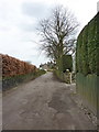
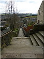
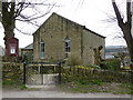
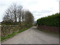
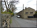
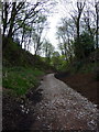
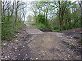
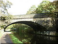
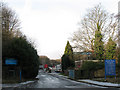

100 photos from this area
Area Information
Key information about the HX4 8AR including its size, population, and administrative classification.
- Area Type
- Postcode
- Area Size
- 3355 m²
- Population
- 1643
- Population Density
- 2132 people/km²
House Prices in HX4 8AR
30
Properties
£87,940
Average Sold Price
£38,500
Lowest Price
£133,675
Highest Price
Showing 30 properties
| Address | Type | Beds | Baths | Last Sale Price | Last Sale Date | |
|---|---|---|---|---|---|---|
| 27 John Street, Greetland, Elland, HX4 8AR | Terraced | 2 | 1 | £133,675 | Aug 2025 | |
| 21 John Street, Greetland, Elland, HX4 8AR | Terraced | 3 | 2 | £130,000 | Feb 2023 | |
| 9 John Street, Greetland, Elland, HX4 8AR | house | 2 | - | £110,000 | Feb 2023 | |
| 11 John Street, Greetland, Elland, HX4 8AR | house | - | - | £110,000 | Mar 2021 | |
| 7 John Street, Greetland, Elland, HX4 8AR | Terraced | 2 | 1 | £109,000 | Mar 2020 | |
| 14 John Street, Greetland, Elland, HX4 8AR | Terraced | 2 | 1 | £96,000 | Dec 2019 | |
| 12 John Street, Greetland, Elland, HX4 8AR | Terraced | 2 | 1 | £72,000 | Nov 2019 | |
| 25 John Street, Greetland, Elland, HX4 8AR | Terraced | 2 | 1 | £71,000 | Mar 2018 | |
| 18 John Street, Greetland, Elland, HX4 8AR | Terraced | 2 | 1 | £93,000 | Jan 2018 | |
| 29 John Street, Greetland, Elland, HX4 8AR | house | - | - | £96,000 | May 2016 |
Page 1 of 3
Energy Efficiency in HX4 8AR
Amenities
Schools
| Rank | School | Type | Entry gender | Ages |
|---|
Explore more schools in this area
Go to Schools tabDemographics
Household Size
One person
most common
Accommodation Type
Houses
most common
Tenure
60
majority
Ethnic Group
White
most common
Religion
N/A
most common
Household Composition
N/A
most common
Age
47
median
Adults (30-64 years)
most common
Household Deprivation
N/A
with no deprivation
NS-SEC
30
in Lower managerial occupations
Explore more demographic insights in this area
Go to Demographics tabPlanning
Planning Constraints
- Flood RiskPremium
- Ramsar Wetland SitesPremium
- Area of Outstanding Natural BeautyPremium
- Protected Nature ReservePremium
- Protected WoodlandPremium