Area Overview for HX4 0BG
Photos of HX4 0BG
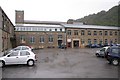
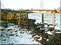
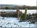
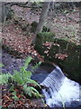
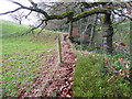
51 photos from this area
Area Information
Key information about the HX4 0BG including its size, population, and administrative classification.
- Area Type
- Postcode
- Area Size
- 62.1 hectares
- Population
- 1505
- Population Density
- 244 people/km²
House Prices in HX4 0BG
20
Properties
£493,333
Average Sold Price
£200,000
Lowest Price
£950,000
Highest Price
Showing 20 properties
| Address | Type | Beds | Baths | Last Sale Price | Last Sale Date | |
|---|---|---|---|---|---|---|
| Bowers Cottage, Bowers Lane, Barkisland, Sowerby Bridge, HX4 0BG | house | - | - | £950,000 | Feb 2023 | |
| Ivy House, Barsey Green Lane, Barkisland, Sowerby Bridge, HX4 0BG | house | - | - | £330,000 | Oct 2014 | |
| Stone Stile Barn, Saddleworth Road, Barkisland, Sowerby Bridge, HX4 0BG | Detached | - | - | £200,000 | Oct 2002 | |
| Shaw Head, Bowers Lane, Barkisland, Sowerby Bridge, HX4 0BG | house | 3 | 1 | - | - | |
| Granny Flat, Ivy House, Barsey Green Lane, Barkisland, Sowerby Bridge, HX4 0BG | Flat | - | - | - | - | |
| Former Barsley Green, Saddleworth Road, Barkisland, Sowerby Bridge, HX4 0BG | Terraced | - | - | - | - | |
| Former Record Bowers Cottage, Saddleworth Road, Barkisland, Sowerby Bridge, HX4 0BG | Detached | - | - | - | - | |
| Bowers Cottage, Bowers Lane, Barkisland, Sowerby Bridge, HX4 0BG | Detached | - | - | - | - | |
| Former The Flat, Barsey Green Farm, Barsey Green Lane, Barkisland, Sowerby Bridge, HX4 0BG | Flat | - | - | - | - | |
| Far Barsey Farm, Saddleworth Road, Barkisland, Sowerby Bridge, HX4 0BG | Semi-detached | - | - | - | - |
Page 1 of 2
Energy Efficiency in HX4 0BG
Amenities
Schools
| Rank | School | Type | Entry gender | Ages |
|---|
Explore more schools in this area
Go to Schools tabDemographics
Household Size
Two person
most common
Accommodation Type
Houses
most common
Tenure
81
majority
Ethnic Group
White
most common
Religion
N/A
most common
Household Composition
N/A
most common
Age
47
median
Adults (30-64 years)
most common
Household Deprivation
N/A
with no deprivation
NS-SEC
45
in Lower managerial occupations
Explore more demographic insights in this area
Go to Demographics tabPlanning
Planning Constraints
- Flood RiskPremium
- Ramsar Wetland SitesPremium
- Area of Outstanding Natural BeautyPremium
- Protected Nature ReservePremium
- Protected WoodlandPremium