Area Overview for HX3 9RY
Photos of HX3 9RY
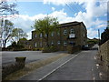
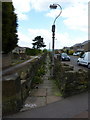
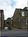
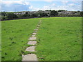

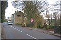

100 photos from this area
Area Information
Key information about the HX3 9RY including its size, population, and administrative classification.
- Area Type
- Postcode
- Area Size
- 8206 m²
- Population
- 1604
- Population Density
- 923 people/km²
House Prices in HX3 9RY
22
Properties
£140,853
Average Sold Price
£38,000
Lowest Price
£220,000
Highest Price
Showing 22 properties
| Address | Type | Beds | Baths | Last Sale Price | Last Sale Date | |
|---|---|---|---|---|---|---|
| 12 Charles Avenue, Southowram, Brighouse, HX3 9RY | Bungalow | 2 | 1 | £130,000 | Jan 2025 | |
| 47 Charles Avenue, Southowram, Brighouse, HX3 9RY | Bungalow | 2 | 1 | £220,000 | Sep 2023 | |
| 51 Charles Avenue, Southowram, Brighouse, HX3 9RY | Bungalow | 2 | 1 | £160,000 | May 2023 | |
| 35 Charles Avenue, Southowram, Brighouse, HX3 9RY | Retail | 2 | 1 | £219,950 | Oct 2022 | |
| 45 Charles Avenue, Southowram, Brighouse, HX3 9RY | Detached | 2 | - | £182,500 | Sep 2021 | |
| 39 Charles Avenue, Southowram, Brighouse, HX3 9RY | Bungalow | - | - | £184,500 | Jul 2021 | |
| 55 Charles Avenue, Southowram, Brighouse, HX3 9RY | Terraced | 3 | 1 | £152,000 | Mar 2021 | |
| 59 Charles Avenue, Southowram, Brighouse, HX3 9RY | Terraced | 3 | - | £172,000 | Mar 2021 | |
| 49 Charles Avenue, Southowram, Brighouse, HX3 9RY | Bungalow | 2 | 1 | £169,950 | Jun 2019 | |
| 57 Charles Avenue, Southowram, Brighouse, HX3 9RY | Terraced | 3 | - | £135,000 | Apr 2017 |
Page 1 of 3
Energy Efficiency in HX3 9RY
Amenities
Schools
| Rank | School | Type | Entry gender | Ages |
|---|
Explore more schools in this area
Go to Schools tabDemographics
Household Size
Two person
most common
Accommodation Type
Houses
most common
Tenure
69
majority
Ethnic Group
White
most common
Religion
N/A
most common
Household Composition
N/A
most common
Age
47
median
Adults (30-64 years)
most common
Household Deprivation
N/A
with no deprivation
NS-SEC
32
in Lower managerial occupations
Explore more demographic insights in this area
Go to Demographics tabPlanning
Planning Constraints
- Flood RiskPremium
- Ramsar Wetland SitesPremium
- Area of Outstanding Natural BeautyPremium
- Protected Nature ReservePremium
- Protected WoodlandPremium