Area Overview for HX3 9EP
Photos of HX3 9EP
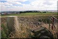
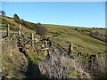
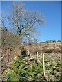

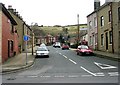
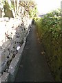
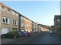
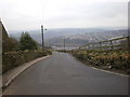
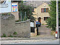
100 photos from this area
Area Information
Key information about the HX3 9EP including its size, population, and administrative classification.
- Area Type
- Postcode
- Area Size
- 2.1 hectares
- Population
- 1711
- Population Density
- 4333 people/km²
House Prices in HX3 9EP
38
Properties
£165,023
Average Sold Price
£122,500
Lowest Price
£233,000
Highest Price
Showing 38 properties
| Address | Type | Beds | Baths | Last Sale Price | Last Sale Date | |
|---|---|---|---|---|---|---|
| 38 Blackberry Way, Siddal, Halifax, HX3 9EP | Semi-detached | 3 | 2 | £185,000 | Feb 2025 | |
| 30 Blackberry Way, Siddal, Halifax, HX3 9EP | house | 3 | 3 | £217,500 | Mar 2024 | |
| 45 Blackberry Way, Siddal, Halifax, HX3 9EP | house | 4 | 3 | £233,000 | Aug 2023 | |
| 27 Blackberry Way, Siddal, Halifax, HX3 9EP | house | 3 | 2 | £230,000 | Mar 2023 | |
| 36 Blackberry Way, Siddal, Halifax, HX3 9EP | Terraced | 3 | 2 | £174,000 | Mar 2022 | |
| 23 Blackberry Way, Siddal, Halifax, HX3 9EP | house | - | - | £200,000 | Sep 2021 | |
| 39 Blackberry Way, Siddal, Halifax, HX3 9EP | house | - | - | £180,000 | Jun 2021 | |
| 47 Blackberry Way, Siddal, Halifax, HX3 9EP | Semi-detached | 4 | 3 | £192,000 | Mar 2021 | |
| 17 Blackberry Way, Siddal, Halifax, HX3 9EP | Terraced | 4 | 2 | £198,000 | Mar 2021 | |
| 52 Blackberry Way, Siddal, Halifax, HX3 9EP | house | - | - | £160,000 | Dec 2020 |
Page 1 of 4
Energy Efficiency in HX3 9EP
Amenities
Schools
| Rank | School | Type | Entry gender | Ages |
|---|
Explore more schools in this area
Go to Schools tabDemographics
Household Size
One person
most common
Accommodation Type
Houses
most common
Tenure
65
majority
Ethnic Group
White
most common
Religion
N/A
most common
Household Composition
N/A
most common
Age
47
median
Adults (30-64 years)
most common
Household Deprivation
N/A
with no deprivation
NS-SEC
28
in Lower managerial occupations
Explore more demographic insights in this area
Go to Demographics tabPlanning
Planning Constraints
- Flood RiskPremium
- Ramsar Wetland SitesPremium
- Area of Outstanding Natural BeautyPremium
- Protected Nature ReservePremium
- Protected WoodlandPremium