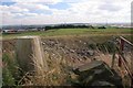
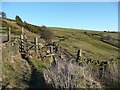
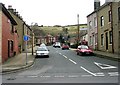
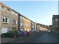
Area Overview for HX3 9BU
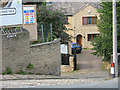
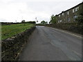
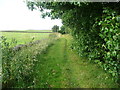
Photos of HX3 9BU


Area Information
HX3 9BU is a small, tightly knit residential cluster in England, home to 1711 residents. Its compact size fosters a quiet, community-focused atmosphere, with daily life shaped by proximity to essential services and transport links. The area’s population skews toward adults aged 30–64, reflecting a stable demographic profile. Residents benefit from excellent broadband connectivity, with a score of 99, ensuring seamless online access for work, education, or leisure. Nearby, five retail outlets—including Tesco Halifax and Asda Halifax—offer convenience for shopping, while five railway stations, such as Halifax and Sowerby Bridge, provide reliable commuting options. This blend of practical amenities and connectivity makes HX3 9BU appealing for those seeking a balanced lifestyle without sacrificing access to urban resources. The area’s low flood risk and absence of environmental restrictions further enhance its appeal, though crime rates remain average, requiring standard precautions. For buyers prioritising stability and accessibility, HX3 9BU offers a straightforward, no-frills living experience.
- Area Type
- Postcode
- Area Size
- Not available
- Population
- 1711
- Population Density
- 4333 people/km²
HX3 9BU is primarily an owner-occupied area, with 65% of homes owned by residents rather than rented. The housing stock consists mainly of houses, which contrasts with areas dominated by flats or apartments. This suggests a market skewed toward family homes and long-term investment, rather than short-term rental properties. The small size of the postcode means the local property market is limited, but proximity to larger towns like Halifax offers broader options for buyers seeking more space or different property types. For those considering HX3 9BU, the focus on owner-occupation implies stable property values and a community of settled residents. However, the limited number of homes may reduce competition, making it a niche market for those prioritising quiet, low-density living over urban vibrancy.
House Prices in HX3 9BU
No properties found in this postcode.
Energy Efficiency in HX3 9BU
Living in HX3 9BU offers access to a range of nearby amenities, including five retail outlets such as Tesco Halifax, Asda Halifax, and Iceland Halifax 2, ensuring everyday shopping needs are met without long trips. The area’s rail network, with stations at Halifax, Sowerby Bridge, and Brighouse, provides easy access to regional transport links, facilitating both commuting and weekend travel. While the postcode itself is small, its proximity to larger towns means residents can enjoy a broader array of dining, leisure, and cultural options beyond the immediate vicinity. The presence of multiple railway stations also supports social connectivity, enabling visits to nearby attractions or events. For those valuing convenience and practicality, HX3 9BU’s amenities are sufficient for daily life, though the area’s compact nature means it is best suited to those who prioritise accessibility over extensive local facilities.
Amenities
Schools
| Rank | School | Type | Entry gender | Ages |
|---|
Explore more schools in this area
Go to Schools tabDemographics
The community in HX3 9BU is predominantly composed of adults aged 30–64, with a median age of 47. This suggests a population focused on established careers and family life, rather than younger or retired residents. Home ownership is high, at 65%, indicating a stable housing market where most residents are long-term occupants. The area is characterised by houses rather than flats, reflecting a preference for single-family living. The predominant ethnic group is White, though no specific data on diversity or deprivation is provided. This demographic profile implies a mature, low-turnover community with needs centred on schools, healthcare, and local amenities. The absence of younger households may mean fewer childcare facilities, but the presence of nearby retail and transport links suggests the area caters to a self-sufficient, active population.
Household Size
Accommodation Type
Tenure
Ethnic Group
Religion
Household Composition
Age
Household Deprivation
NS-SEC
Explore more demographic insights in this area
Go to Demographics tabPlanning
Planning Constraints
- Flood RiskPremium
- Ramsar Wetland SitesPremium
- Area of Outstanding Natural BeautyPremium
- Protected Nature ReservePremium
- Protected WoodlandPremium